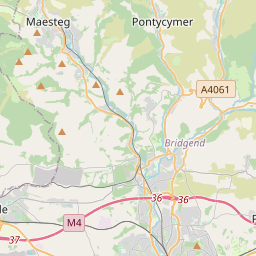


Current traffic around Bridgend
The following traffic incidents and congestion for Bridgend have been reported by Highways England, Traffic Scotland, Traffic Wales or Transport for London (TfL) in the last two hours:
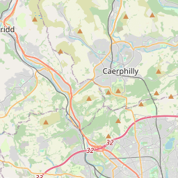
ABERCYNON ROUNDABOUT Description: A470Both directionsAbercynon RoundaboutRoadworksTemporary traffic lights06/01/25-13/06/25 2000-0600Delay: s possible :, Start time: 06/01/2025 20:00 , End Date: 13/06/2025 6:00, Severity: Moderate, Source: Welsh Government, Last updated: 06/01/2025 20:00
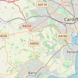
Nearest town: 15.06 miles from Bridgend. CLEARED @ 19:06J33 CAPEL LLANILLTERN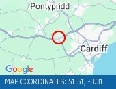 Description: M4EastboundJ33 (Cardiff) Capel LlanillternCongestionoffslipDelay: s possible :, Start time: 25/04/2025 17:27 , Expected end time: 25/04/2025 21:27, Severity: Moderate, Source: Welsh Government, Last updated: 25/04/2025 17:27
Nearest town: 11.55 miles from Bridgend. CLEARED @ 17:42NORTHBOUND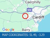 Description: A4232Now clearNorthboundA48 Interchange to M4 J33 Capel Llanilltern, Start time: 25/04/2025 17:39 , Expected end time: 25/04/2025 17:44, Severity: Moderate, Source: Welsh Government, Last updated: 25/04/2025 17:39
Nearest town: 12.47 miles from Bridgend. CLEARED @ 17:42CORYTON TO NANTGARW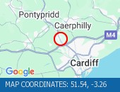 Description: A470NorthboundCoryton to NantgarwCongestionDelay: s possible :, Start time: 25/04/2025 16:52 , Expected end time: 25/04/2025 19:52, Severity: Moderate, Source: Welsh Government, Last updated: 25/04/2025 16:52
Nearest town: 13.78 miles from Bridgend. CLEARED @ 17:06J39 GROES TO J43 LLANDARCY Description: M4WestboundJ39 Groes to J43 (Neath) LlandarcyCongestionDelay: s possible :, Start time: 25/04/2025 14:04 , Expected end time: 25/04/2025 20:04, Severity: Moderate, Source: Welsh Government, Last updated: 25/04/2025 14:04
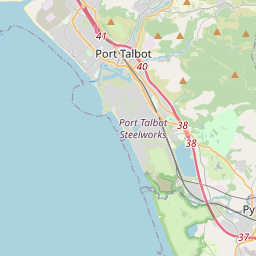
Nearest town: 12.02 miles from Bridgend. CLEARED @ 14:06BRITON FERRY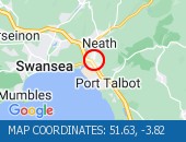 Description: A48EastboundBriton FerryStructural inspectionsRoad closedDiversions in place08/04/25-13/05/25 2000-0600 :, Start time: 08/04/2025 20:00 , End Date: 13/05/2025 6:00, Severity: Road closure, Source: Welsh Government, Last updated: 11/04/2025 16:41
Nearest town: 13.51 miles from Bridgend. CLEARED @ 17:54J42 EARLSWOOD ON SLIP TO A48 Description: M4EastboundJ42 (Swansea) Earlswood on slip to A48Resurfacing workClosedDiversions in place08/04/25-11/05/25 2000-0600 :, Start time: 08/04/2025 20:00 , End Date: 11/05/2025 6:00, Severity: Road closure, Source: Welsh Government, Last updated: 08/04/2025 20:00
Nearest town: 14.33 miles from Bridgend. CLEARED @ 17:06J43 LLANDARCY Description: M4EastboundJ43 (Neath) LlandarcyResurfacing workOnslip closedDiversions in place08/04/25-11/05/25 2000-0600 :, Start time: 08/04/2025 20:00 , End Date: 11/05/2025 6:00, Severity: Road closure, Source: Welsh Government, Last updated: 08/04/2025 20:00
Nearest town: 15.4 miles from Bridgend. CLEARED @ 16:54
Nearest town: 15.06 miles from Bridgend. CLEARED @ 19:06
Nearest town: 11.55 miles from Bridgend. CLEARED @ 17:42
Nearest town: 12.47 miles from Bridgend. CLEARED @ 17:42
Nearest town: 13.78 miles from Bridgend. CLEARED @ 17:06
Nearest town: 12.02 miles from Bridgend. CLEARED @ 14:06
Nearest town: 13.51 miles from Bridgend. CLEARED @ 17:54
Nearest town: 14.33 miles from Bridgend. CLEARED @ 17:06
Nearest town: 15.4 miles from Bridgend. CLEARED @ 16:54
There are no current incidents in this location.


 National Highways England
 Transport for London (TFL)
 Traffic Wales
 Traffic Scotland
 YOUR AD HERE