Current traffic around Pontyclun
The following traffic incidents and congestion for Pontyclun have been reported by Highways England, Traffic Scotland, Traffic Wales or Transport for London (TfL) in the last two hours:
J29 CASTLETON TO J30 CARDIFF GATE Description: M4WestboundJ29 (Cardiff) Castleton to J30 (Cardiff) Cardiff GateCongestionDelay: s possible :, Start time: 15/12/2025 8:28 , Expected end time: 15/12/2025 9:58, Severity: Moderate, Source: Welsh Government, Last updated: 15/12/2025 8:28
Nearest town: 12.97 miles from Pontyclun. CLEARED @ 08:42M4 J33 CAPEL LLANILLTERN TO A48 INTERCHANGE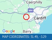 Description: A4232SouthboundM4 J33 Capel Llanilltern to A48 InterchangeCongestionDelay: s possible :, Start time: 15/12/2025 8:21 , Expected end time: 15/12/2025 9:51, Severity: Moderate, Source: Welsh Government, Last updated: 15/12/2025 8:21
Nearest town: 5.21 miles from Pontyclun. CLEARED @ 08:30J33 CAPEL LLANILLTERN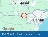 Description: M4WestboundJ33 (Cardiff) Capel LlanillternCongestionoffslipDelay: s possible :, Start time: 15/12/2025 8:21 , Expected end time: 15/12/2025 9:51, Severity: Moderate, Source: Welsh Government, Last updated: 15/12/2025 8:21
Nearest town: 4 miles from Pontyclun. CLEARED @ 08:30J33 CAPEL LLANILLTERNDescription: M4EastboundJ33 (Cardiff) Capel LlanillternCongestionoffslipDelay: s possible :, Start time: 15/12/2025 8:09 , Expected end time: 15/12/2025 10:09, Severity: Moderate, Source: Welsh Government, Last updated: 15/12/2025 8:09
Nearest town: 4 miles from Pontyclun. CLEARED @ 08:18J29 CASTLETON TO J29A ST MELLONS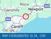 Description: A48MWestboundJ29 Castleton to J29A St MellonsCongestionDelay: s possible :, Start time: 15/12/2025 8:12 , Expected end time: 15/12/2025 10:12, Severity: Moderate, Source: Welsh Government, Last updated: 15/12/2025 8:12
Nearest town: 13.43 miles from Pontyclun. CLEARED @ 08:18A48 INTERCHANGE TO M4 J33 CAPEL LLANILLTERNDescription: A4232NorthboundA48 Interchange to M4 J33 Capel LlanillternCongestionDelay: s possible :, Start time: 15/12/2025 8:12 , Expected end time: 15/12/2025 10:12, Severity: Moderate, Source: Welsh Government, Last updated: 15/12/2025 8:12
Nearest town: 5.21 miles from Pontyclun. CLEARED @ 08:18J28 TREDEGAR PARK TO J24 COLDRA Description: M4EastboundJ28 (Newport) Tredegar Park to J24 (Newport) ColdraCongestionDelay: s possible :, Start time: 15/12/2025 7:16 , Expected end time: 15/12/2025 9:16, Severity: Moderate, Source: Welsh Government, Last updated: 15/12/2025 7:16
Nearest town: 18.26 miles from Pontyclun. CLEARED @ 07:30PONTYPRIDD TO CORYTON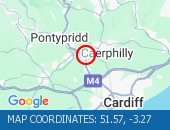 Description: A470SouthboundPontypridd to CorytonCongestion :, Start time: 15/12/2025 6:44 , Expected end time: 15/12/2025 12:44, Severity: Moderate, Source: Welsh Government, Last updated: 15/12/2025 6:44
Nearest town: 6.35 miles from Pontyclun. CLEARED @ 06:54J38 MARGAM TO J39 GROES Description: M4WestboundJ38 (Port Talbot) Margam to J39 GroesIncidentLane closedDelay: s possible :, Start time: 15/12/2025 6:25 , Expected end time: 15/12/2025 9:00, Severity: Moderate, Source: Welsh Government, Last updated: 15/12/2025 6:25
Nearest town: 15.15 miles from Pontyclun. CLEARED @ 06:42NANTGARW TO TAFF'S WELL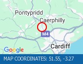 Description: A470SouthboundNantgarw to Taffs WellIncidentLane closedDelay: s possible :, Start time: 15/12/2025 6:17 , Expected end time: 15/12/2025 8:00, Severity: Moderate, Source: Welsh Government, Last updated: 15/12/2025 6:17
Nearest town: 6 miles from Pontyclun. CLEARED @ 06:30TAFF'S WELL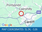 Description: A470NorthboundTaffs Well15/12/25-16/12/25 2000-0600Maintenance workEntry slip road closedDiversions in place :, Start time: 15/12/2025 20:00 , End Date: 16/12/2025 6:00, Severity: Road closure, Source: Welsh Government, Last updated: 13/12/2025 11:42
Nearest town: 6.13 miles from Pontyclun.UPPER BOAT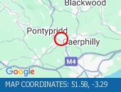 Description: A470NorthboundUpper Boat18/12/25-20/12/25 2000-0600Maintenance workEntry slip road closedDiversions in place :, Start time: 18/12/2025 20:00 , End Date: 20/12/2025 6:00, Severity: Road closure, Source: Welsh Government, Last updated: 13/12/2025 11:45
Nearest town: 6.14 miles from Pontyclun.UPPER BOATDescription: A470NorthboundUpper Boat18/12/25-19/12/25 2000-0600Maintenance workExit slip road closedDiversions in place :, Start time: 18/12/2025 20:00 , End Date: 19/12/2025 6:00, Severity: Road closure, Source: Welsh Government, Last updated: 13/12/2025 11:48
Nearest town: 6.14 miles from Pontyclun.M4 J33 CAPEL LLANILLTERNDescription: A4232EastboundM4 J33 Capel Llanilltern11/12/25-19/12/25 2000-0600Maintenance workExit slip road closedDiversions in place :, Start time: 11/12/2025 20:00 , End Date: 19/12/2025 6:00, Severity: Road closure, Source: Welsh Government, Last updated: 13/12/2025 11:38
Nearest town: 4 miles from Pontyclun. CLEARED @ 11:54J30 CARDIFF GATE TO J49 PONT ABRAHAM Description: M4Both directionsJ30 (Cardiff) Cardiff Gate to J49 Pont AbrahamSpeed restrictions Due to Poor driving conditions :, Start time: 15/12/2025 6:04 , Expected end time: 15/12/2025 16:00, Severity: Slight, Source: Welsh Government, Last updated: 15/12/2025 6:04
Nearest town: 12.42 miles from Pontyclun. CLEARED @ 10:54
Nearest town: 12.97 miles from Pontyclun. CLEARED @ 08:42
Nearest town: 5.21 miles from Pontyclun. CLEARED @ 08:30
Nearest town: 4 miles from Pontyclun. CLEARED @ 08:30
Nearest town: 4 miles from Pontyclun. CLEARED @ 08:18
Nearest town: 13.43 miles from Pontyclun. CLEARED @ 08:18
Nearest town: 5.21 miles from Pontyclun. CLEARED @ 08:18
Nearest town: 18.26 miles from Pontyclun. CLEARED @ 07:30
Nearest town: 6.35 miles from Pontyclun. CLEARED @ 06:54
Nearest town: 15.15 miles from Pontyclun. CLEARED @ 06:42
Nearest town: 6 miles from Pontyclun. CLEARED @ 06:30
Nearest town: 6.13 miles from Pontyclun.
Nearest town: 6.14 miles from Pontyclun.
Nearest town: 6.14 miles from Pontyclun.
Nearest town: 4 miles from Pontyclun. CLEARED @ 11:54
Nearest town: 12.42 miles from Pontyclun. CLEARED @ 10:54
There are no current incidents in this location.


 National Highways England
 Transport for London (TFL)
 Traffic Wales
 Traffic Scotland
 YOUR AD HERE