
Current traffic around Pentyrch
The following traffic incidents and congestion for Pentyrch have been reported by Highways England, Traffic Scotland, Traffic Wales or Transport for London (TfL) in the last two hours:
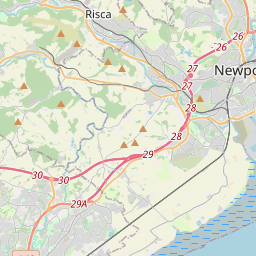
EASTBOUND Description: M4Now clearEastboundJ28 (Newport) Tredegar Park to J24 (Newport) Coldra, Start time: 19/03/2025 9:06 , Expected end time: 19/03/2025 9:11, Severity: Moderate, Source: Welsh Government, Last updated: 19/03/2025 9:06
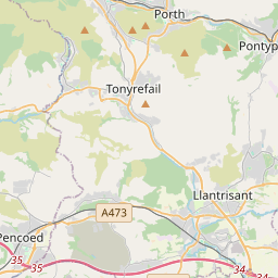
Nearest town: 13.96 miles from Pentyrch. CLEARED @ 10:30NORTHBOUND Description: A470Now clearNorthboundNantgarw, Start time: 19/03/2025 9:05 , Expected end time: 19/03/2025 9:10, Severity: Moderate, Source: Welsh Government, Last updated: 19/03/2025 9:05
Nearest town: 2.56 miles from Pentyrch. CLEARED @ 10:30SOUTHBOUND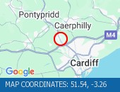 Description: A470Now clearSouthboundNantgarw to Coryton, Start time: 19/03/2025 9:00 , Expected end time: 19/03/2025 9:05, Severity: Moderate, Source: Welsh Government, Last updated: 19/03/2025 9:00
Nearest town: 1.82 miles from Pentyrch. CLEARED @ 09:18NORTHBOUND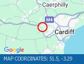 Description: A4232Now clearNorthboundSt Fagans to M4 J33 Capel Llanilltern, Start time: 19/03/2025 8:59 , Expected end time: 19/03/2025 9:04, Severity: Moderate, Source: Welsh Government, Last updated: 19/03/2025 8:59
Nearest town: 2.39 miles from Pentyrch. CLEARED @ 09:18EASTBOUND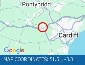 Description: M4Now clearEastboundJ33 (Cardiff) Capel Llanilltern, Start time: 19/03/2025 8:59 , Expected end time: 19/03/2025 9:04, Severity: Moderate, Source: Welsh Government, Last updated: 19/03/2025 8:59
Nearest town: 1.64 miles from Pentyrch. CLEARED @ 09:18SOUTHBOUND Description: A4232Now clearSouthboundM4 J33 Capel Llanilltern to A48 Interchange, Start time: 19/03/2025 8:59 , Expected end time: 19/03/2025 9:04, Severity: Moderate, Source: Welsh Government, Last updated: 19/03/2025 8:59
Nearest town: 2.83 miles from Pentyrch. CLEARED @ 09:18EASTBOUND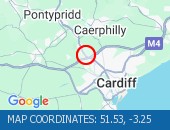 Description: M4Now clearEastboundJ32 (Cardiff) Coryton, Start time: 19/03/2025 8:14 , Expected end time: 19/03/2025 8:19, Severity: Moderate, Source: Welsh Government, Last updated: 19/03/2025 8:14
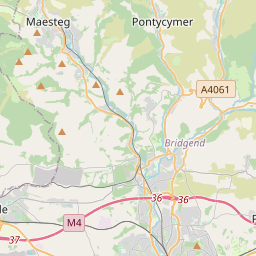
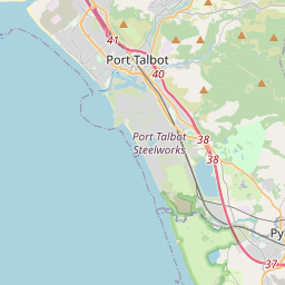
Nearest town: 2.31 miles from Pentyrch. CLEARED @ 09:06J36 SARN TO J37 PYLE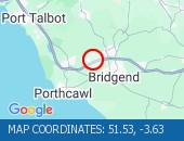 Description: M4WestboundJ36 (Bridgend) Sarn to J37 (Porthcawl) PyleResurfacing workRoad closedDiversions in place19/03/25-21/03/25 2000-0600 :, Start time: 19/03/2025 20:00 , End Date: 21/03/2025 6:00, Severity: Road closure, Source: Welsh Government, Last updated: 15/03/2025 8:18
Nearest town: 14.42 miles from Pentyrch. CLEARED @ 08:54J38 MARGAM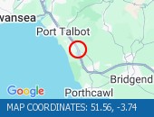 Description: M4EastboundJ38 (Port Talbot) MargamResurfacing workEntry slip road closedDiversions in place21/03/25-22/03/25 2000-0600 :, Start time: 21/03/2025 20:00 , End Date: 22/03/2025 6:00, Severity: Road closure, Source: Welsh Government, Last updated: 15/03/2025 8:21
Nearest town: 19.1 miles from Pentyrch. CLEARED @ 08:42
Nearest town: 13.96 miles from Pentyrch. CLEARED @ 10:30
Nearest town: 2.56 miles from Pentyrch. CLEARED @ 10:30
Nearest town: 1.82 miles from Pentyrch. CLEARED @ 09:18
Nearest town: 2.39 miles from Pentyrch. CLEARED @ 09:18
Nearest town: 1.64 miles from Pentyrch. CLEARED @ 09:18
Nearest town: 2.83 miles from Pentyrch. CLEARED @ 09:18
Nearest town: 2.31 miles from Pentyrch. CLEARED @ 09:06
Nearest town: 14.42 miles from Pentyrch. CLEARED @ 08:54
Nearest town: 19.1 miles from Pentyrch. CLEARED @ 08:42
There are no current incidents in this location.


 National Highways England
 Transport for London (TFL)
 Traffic Wales
 Traffic Scotland
 YOUR AD HERE