


Current traffic around Pentre Poid
The following traffic incidents and congestion for Pentre Poid have been reported by Highways England, Traffic Scotland, Traffic Wales or Transport for London (TfL) in the last two hours:
M4 J33 CAPEL LLANILLTERN TO A48 INTERCHANGE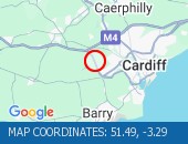 Description: A4232SouthboundM4 J33 Capel Llanilltern to A48 InterchangeCongestion :, Start time: 21/05/2025 8:43 , Expected end time: 21/05/2025 10:43, Severity: Moderate, Source: Welsh Government, Last updated: 21/05/2025 8:43
Nearest town: 17.96 miles from Pentre Poid. CLEARED @ 08:55J34 MISKIN TO J33 CAPEL LLANILLTERN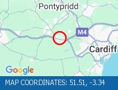 Description: M4EastboundJ34 (Llantrisant) Miskin to J33 (Cardiff) Capel LlanillternCongestion :, Start time: 21/05/2025 8:10 , Expected end time: 21/05/2025 10:10, Severity: Moderate, Source: Welsh Government, Last updated: 21/05/2025 8:10
Nearest town: 18.08 miles from Pentre Poid. CLEARED @ 08:19A48 INTERCHANGE TO M4 J33 CAPEL LLANILLTERNDescription: A4232NorthboundA48 Interchange to M4 J33 Capel LlanillternCongestion :, Start time: 21/05/2025 7:52 , Expected end time: 21/05/2025 9:52, Severity: Moderate, Source: Welsh Government, Last updated: 21/05/2025 7:52
Nearest town: 17.96 miles from Pentre Poid. CLEARED @ 08:07J33 CAPEL LLANILLTERN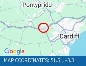 Description: M4EastboundJ33 (Cardiff) Capel LlanillternCongestionDelay: s possible :, Start time: 21/05/2025 7:20 , Expected end time: 21/05/2025 11:20, Severity: Moderate, Source: Welsh Government, Last updated: 21/05/2025 7:20
Nearest town: 17.42 miles from Pentre Poid. CLEARED @ 07:31PONTYPRIDD TO CORYTON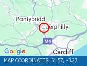 Description: A470SouthboundPontypridd to CorytonCongestionDelay: s possible :, Start time: 21/05/2025 7:09 , Expected end time: 21/05/2025 11:09, Severity: Moderate, Source: Welsh Government, Last updated: 21/05/2025 7:09
Nearest town: 13.23 miles from Pentre Poid. CLEARED @ 07:19TUA'R DWYRAIN Disgrifiad: M4Wedi clirioTuar DwyrainC28 Parc Tredegar i G26 Malpas, Amser y digwyddiad: 21/05/2025 10:10 , Amser gorffen a ragwelir: 21/05/2025 10:15, Difrifoldeb: Rhywfaint, Ffynhonnell: Llywodraeth Cymru, Diweddarwyd ddiwethaf: 21/05/2025 10:10
Nearest town: 8.66 miles from Pentre Poid. CLEARED @ 10:31TUA'R DEDisgrifiad: A470Wedi clirioTuar DePontypridd i Coryton, Amser y digwyddiad: 21/05/2025 10:07 , Amser gorffen a ragwelir: 21/05/2025 10:12, Difrifoldeb: Cymedrol, Ffynhonnell: Llywodraeth Cymru, Diweddarwyd ddiwethaf: 21/05/2025 10:07
Nearest town: 13.23 miles from Pentre Poid. CLEARED @ 10:31TUA'R DEDisgrifiad: A4232Wedi clirioTuar DeM4 C33 Llanilltern i Cyfnewidfa A48, Amser y digwyddiad: 21/05/2025 10:13 , Amser gorffen a ragwelir: 21/05/2025 10:18, Difrifoldeb: Cymedrol, Ffynhonnell: Llywodraeth Cymru, Diweddarwyd ddiwethaf: 21/05/2025 10:13
Nearest town: 17.96 miles from Pentre Poid. CLEARED @ 10:31J25A GROVE PARK TO J28 TREDEGAR PARK Description: M4WestboundJ25A (Newport) Grove Park to J28 (Newport) Tredegar ParkMaintenance workTunnel closedDiversions in place20/05/25-22/05/25 2000-0600 :, Start time: 20/05/2025 20:00 , End Date: 22/05/2025 6:00, Severity: Road closure, Source: Welsh Government, Last updated: 20/05/2025 20:00
Nearest town: 8.45 miles from Pentre Poid. CLEARED @ 09:19J22 PILNING/PRINCE OF WALES BRIDGE TO J23 ROGIET Description: M4Both directionsJ22 (Avonmouth) Pilning/Prince of Wales Bridge to J23 (Chepstow) RogietMaintenance workBridge closedDiversions in place19/05/25-22/05/25 2100-0600 :, Start time: 19/05/2025 21:00 , End Date: 22/05/2025 6:00, Severity: Road closure, Source: Welsh Government, Last updated: 19/05/2025 21:00
Nearest town: 16.99 miles from Pentre Poid. CLEARED @ 09:07A472 INTERCHANGE TO NEW INN Description: A4042Both directionsA472 Interchange to New InnElectrical workRoad closedDiversions in place19/05/25-23/05/25 2000-0600 :, Start time: 19/05/2025 20:00 , End Date: 23/05/2025 6:00, Severity: Road closure, Source: Welsh Government, Last updated: 19/05/2025 20:00
Nearest town: 2.68 miles from Pentre Poid. CLEARED @ 08:43PONTYPRIDD TO UPPER BOAT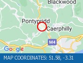 Description: A470SouthboundPontypridd to Upper BoatCyclic maintenanceRoad closedDiversions in place21/05/25-23/05/25 2000-0600 :, Start time: 21/05/2025 20:00 , End Date: 23/05/2025 6:00, Severity: Road closure, Source: Welsh Government, Last updated: 17/05/2025 8:12
Nearest town: 13.46 miles from Pentre Poid. CLEARED @ 08:43EASTBOUNDDescription: M4Now clearEastboundJ28 (Newport) Tredegar Park to J26 (Newport) Malpas, Start time: 21/05/2025 10:10 , Expected end time: 21/05/2025 10:15, Severity: Slight, Source: Welsh Government, Last updated: 21/05/2025 10:10
Nearest town: 8.66 miles from Pentre Poid. CLEARED @ 10:19
Nearest town: 17.96 miles from Pentre Poid. CLEARED @ 08:55
Nearest town: 18.08 miles from Pentre Poid. CLEARED @ 08:19
Nearest town: 17.96 miles from Pentre Poid. CLEARED @ 08:07
Nearest town: 17.42 miles from Pentre Poid. CLEARED @ 07:31
Nearest town: 13.23 miles from Pentre Poid. CLEARED @ 07:19
Nearest town: 8.66 miles from Pentre Poid. CLEARED @ 10:31
Nearest town: 13.23 miles from Pentre Poid. CLEARED @ 10:31
Nearest town: 17.96 miles from Pentre Poid. CLEARED @ 10:31
Nearest town: 8.45 miles from Pentre Poid. CLEARED @ 09:19
Nearest town: 16.99 miles from Pentre Poid. CLEARED @ 09:07
Nearest town: 2.68 miles from Pentre Poid. CLEARED @ 08:43
Nearest town: 13.46 miles from Pentre Poid. CLEARED @ 08:43
Nearest town: 8.66 miles from Pentre Poid. CLEARED @ 10:19
There are no current incidents in this location.


 National Highways England
 Transport for London (TFL)
 Traffic Wales
 Traffic Scotland
 YOUR AD HERE