Traffic incidents
The following traffic incidents and congestion for A19 have been reported by Highways England, Traffic Scotland, Traffic Wales or Transport for London (TfL) in the last two hours:
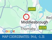
Lane closures: Lane one is closed.
Reason: Vehicle fire.
Status: Currently Active.
Time to clear: The event is expected to clear between 21:30 and 21:45 on 16 May 2025.
Return to normal: Normal traffic conditions are expected between 21:30 and 21:45 on 16 May 2025.
Lanes closed: There is one of three lanes closed.
Nearest town: 4.54m from Stockton-on-Tees. CLEARED @ 19:03
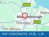
Lane closures: Lane one is closed.
Reason: Broken down vehicle.
Status: Currently Active.
Time to clear: The event is expected to clear between 21:15 and 21:30 on 16 May 2025.
Return to normal: Normal traffic conditions are expected between 21:15 and 21:30 on 16 May 2025.
Lanes closed: There is one of two lanes closed.
Nearest town: 4.64m from Middlesbrough.

Lane closures: Lane one is closed.
Reason: Road traffic collision.
Status: Currently Active.
Time to clear: The event is expected to clear between 17:45 and 18:00 on 16 May 2025.
Return to normal: Normal traffic conditions are expected between 17:45 and 18:00 on 16 May 2025.
Lanes closed: There is one of two lanes closed.
Nearest town: 4.42m from Middlesbrough. CLEARED @ 16:48
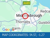
Reason: Broken down vehicle.
Status: Cleared.
Nearest town: 4.23m from Middlesbrough. CLEARED @ 17:06
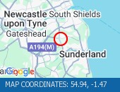
Lane closures: Lane two is closed.
Reason: Broken down vehicle.
Status: Currently Active.
Time to clear: The event is expected to clear between 15:45 and 16:00 on 16 May 2025.
Return to normal: Normal traffic conditions are expected between 15:45 and 16:00 on 16 May 2025.
Lanes closed: There is one of two lanes closed.
Nearest town: 2.65m from Jarrow. CLEARED @ 15:18

Reason: Congestion.
Status: Currently Active.
Return to normal: Normal traffic conditions are expected between 18:15 and 18:30 on 16 May 2025.
CauseVehicle fire.
Delay: There are currently delays of 10 minutes against expected traffic.
Nearest town: 4.34m from Stockton-on-Tees. CLEARED @ 18:09

Reason: Congestion.
Status: Currently Active.
Return to normal: Normal traffic conditions are expected between 16:45 and 17:00 on 16 May 2025.
Nearest town: 7.12m from Hartlepool. CLEARED @ 16:48
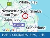
Reason: Congestion.
Status: Currently Active.
Return to normal: Normal traffic conditions are expected between 17:00 and 17:15 on 16 May 2025.
Delay: There are currently delays of 10 minutes against expected traffic.
Nearest town: 1.13m from Jarrow. CLEARED @ 16:57

Reason: Congestion.
Status: Currently Active.
Return to normal: Normal traffic conditions are expected between 17:00 and 17:15 on 16 May 2025.
Delay: There are currently delays of 10 minutes against expected traffic.
Earlier Reason: Caused by the earlier broken down vehicle.
Nearest town: 4.5m from Middlesbrough. CLEARED @ 17:06
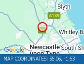
Reason: Congestion.
Status: Currently Active.
Return to normal: Normal traffic conditions are expected between 15:00 and 15:15 on 16 May 2025.
Nearest town: 5.34m from Newcastle Upon Tyne. CLEARED @ 15:00

Reason: Congestion.
Status: Currently Active.
Return to normal: Normal traffic conditions are expected between 14:30 and 14:45 on 16 May 2025.
Nearest town: 2.65m from Jarrow. CLEARED @ 14:33
There are no current incidents in this location.




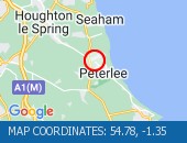


 National Highways England
 Transport for London (TFL)
 Traffic Wales
 Traffic Scotland
 YOUR AD HERE