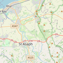


Current traffic around St. Asaph
The following traffic incidents and congestion for St. Asaph have been reported by Highways England, Traffic Scotland, Traffic Wales or Transport for London (TfL) in the last two hours:
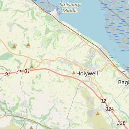
J16 PUFFIN ROUNDABOUT Description: A55WestboundJ16 Puffin RoundaboutonslipCyclic maintenanceEntry slip road closed27/05/25-28/05/25 1930-0600 :, Start time: 27/05/2025 19:30 , End Date: 28/05/2025 6:00, Severity: Road closure, Source: Welsh Government, Last updated: 23/05/2025 11:17
Nearest town: 19.44 miles from St. Asaph. CLEARED @ 11:30J16 PUFFIN ROUNDABOUTDescription: A55WestboundJ16 Puffin RoundaboutoffslipCyclic maintenanceExit slip road closedDiversions in place27/05/25-28/05/25 1930-0600 :, Start time: 27/05/2025 19:30 , End Date: 28/05/2025 6:00, Severity: Road closure, Source: Welsh Government, Last updated: 23/05/2025 11:18
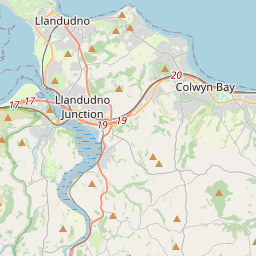
Nearest town: 19.44 miles from St. Asaph. CLEARED @ 11:30J18 LLANDUDNO JUNCTION Description: A55EastboundJ18 Llandudno JunctionoffslipCyclic maintenanceExit slip road closedDiversions in place29/05/25-30/05/25 2000-0700 :, Start time: 29/05/2025 20:00 , End Date: 30/05/2025 7:00, Severity: Road closure, Source: Welsh Government, Last updated: 23/05/2025 11:20
Nearest town: 15.3 miles from St. Asaph. CLEARED @ 11:30J17 CONWY MORFA Description: A55EastboundJ17 Conwy MorfaoffslipCyclic maintenanceExit slip road closedDiversions in place27/05/25-28/05/25 1930-0600 :, Start time: 27/05/2025 19:30 , End Date: 28/05/2025 6:00, Severity: Road closure, Source: Welsh Government, Last updated: 23/05/2025 11:12
Nearest town: 17.21 miles from St. Asaph. CLEARED @ 11:18J17 CONWY MORFADescription: A55WestboundJ17 Conwy MorfaonslipCyclic maintenanceEntry slip road closedDiversions in place27/05/25-28/05/25 1930-0600 :, Start time: 27/05/2025 19:30 , End Date: 28/05/2025 6:00, Severity: Road closure, Source: Welsh Government, Last updated: 23/05/2025 11:14
Nearest town: 17.21 miles from St. Asaph. CLEARED @ 11:18
Nearest town: 19.44 miles from St. Asaph. CLEARED @ 11:30
Nearest town: 19.44 miles from St. Asaph. CLEARED @ 11:30
Nearest town: 15.3 miles from St. Asaph. CLEARED @ 11:30
Nearest town: 17.21 miles from St. Asaph. CLEARED @ 11:18
Nearest town: 17.21 miles from St. Asaph. CLEARED @ 11:18
There are no current incidents in this location.


 National Highways England
 Transport for London (TFL)
 Traffic Wales
 Traffic Scotland
 YOUR AD HERE