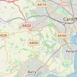


Current traffic around Pwll Mawr
The following traffic incidents and congestion for Pwll Mawr have been reported by Highways England, Traffic Scotland, Traffic Wales or Transport for London (TfL) in the last two hours:
J23A MAGOR TO J26 MALPAS Description: M4WestboundJ23A (Magor) Magor to J26 (Newport) MalpasCongestion :, Start time: 23/05/2025 19:58 , Expected end time: 23/05/2025 20:58, Severity: Moderate, Source: Welsh Government, Last updated: 23/05/2025 19:58
Nearest town: 11.24 miles from Pwll Mawr. CLEARED @ 20:18EASTBOUND Description: M4Now clearEastboundJ28 (Newport) Tredegar Park to J26 (Newport) Malpas, Start time: 23/05/2025 17:53 , Expected end time: 23/05/2025 17:58, Severity: Moderate, Source: Welsh Government, Last updated: 23/05/2025 17:53
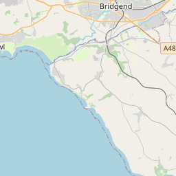
Nearest town: 7.34 miles from Pwll Mawr. CLEARED @ 18:30NORTHBOUND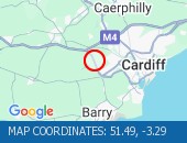 Description: A4232Now clearNorthboundA48 Interchange to M4 J33 Capel Llanilltern, Start time: 23/05/2025 18:07 , Expected end time: 23/05/2025 18:12, Severity: Moderate, Source: Welsh Government, Last updated: 23/05/2025 18:07
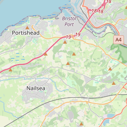
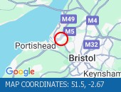
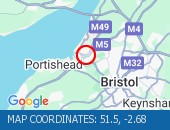
Nearest town: 7.05 miles from Pwll Mawr. CLEARED @ 18:30CONGESTION Location: The M5 southbound between junctions J19 (Portishead) and J20 (Nailsea) .
Reason: Congestion.
Status: Currently Active.
Return to normal: Normal traffic conditions are expected between 20:30 and 20:45 on 23 May 2025.
Delay: There are currently delays of 10 minutes against expected traffic.
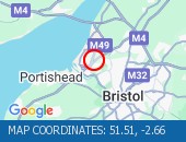
Nearest town: 16.83 miles from Pwll Mawr. CLEARED @ 20:33CONGESTION Location: The M5 southbound between junctions J19 (Portishead) and J20 (Nailsea) .
Reason: Congestion.
Status: Currently Active.
Return to normal: Normal traffic conditions are expected between 20:15 and 20:30 on 23 May 2025.
Delay: There are currently delays of 10 minutes against expected traffic.
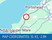
Nearest town: 15.35 miles from Pwll Mawr. CLEARED @ 20:15CONGESTIONLocation: The M5 southbound between junctions J19 (Portishead) and J20 (Nailsea) .
Reason: Congestion.
Status: Currently Active.
Return to normal: Normal traffic conditions are expected between 19:00 and 19:15 on 23 May 2025.
Delay: There are currently delays of 10 minutes against expected traffic.
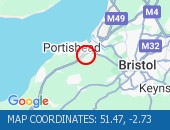
Nearest town: 16.83 miles from Pwll Mawr. CLEARED @ 19:12CONGESTION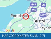 Location: The M5 southbound at junction J19 (Portishead) .
Reason: Congestion.
Status: Currently Active.
Return to normal: Normal traffic conditions are expected between 18:45 and 19:00 on 23 May 2025.
Delay: There are currently delays of 10 minutes against expected traffic.
Nearest town: 17.83 miles from Pwll Mawr. CLEARED @ 18:54CONGESTIONLocation: The M5 southbound between junctions J19 (Portishead) and J20 (Nailsea) .
Reason: Congestion.
Status: Currently Active.
Return to normal: Normal traffic conditions are expected between 18:15 and 18:30 on 23 May 2025.
Delay: There are currently delays of 10 minutes against expected traffic.
Nearest town: 16.83 miles from Pwll Mawr. CLEARED @ 18:18CONGESTIONLocation: The M5 southbound between junctions J19 (Portishead) and J20 (Nailsea) .
Reason: Congestion.
Status: Currently Active.
Return to normal: Normal traffic conditions are expected between 18:00 and 18:15 on 23 May 2025.
Delay: There are currently delays of 10 minutes against expected traffic.
Nearest town: 16.83 miles from Pwll Mawr. CLEARED @ 18:00
Nearest town: 11.24 miles from Pwll Mawr. CLEARED @ 20:18
Nearest town: 7.34 miles from Pwll Mawr. CLEARED @ 18:30
Nearest town: 7.05 miles from Pwll Mawr. CLEARED @ 18:30
Reason: Congestion.
Status: Currently Active.
Return to normal: Normal traffic conditions are expected between 20:30 and 20:45 on 23 May 2025.
Delay: There are currently delays of 10 minutes against expected traffic.
Nearest town: 16.83 miles from Pwll Mawr. CLEARED @ 20:33
Reason: Congestion.
Status: Currently Active.
Return to normal: Normal traffic conditions are expected between 20:15 and 20:30 on 23 May 2025.
Delay: There are currently delays of 10 minutes against expected traffic.
Nearest town: 15.35 miles from Pwll Mawr. CLEARED @ 20:15
Reason: Congestion.
Status: Currently Active.
Return to normal: Normal traffic conditions are expected between 19:00 and 19:15 on 23 May 2025.
Delay: There are currently delays of 10 minutes against expected traffic.
Nearest town: 16.83 miles from Pwll Mawr. CLEARED @ 19:12
Reason: Congestion.
Status: Currently Active.
Return to normal: Normal traffic conditions are expected between 18:45 and 19:00 on 23 May 2025.
Delay: There are currently delays of 10 minutes against expected traffic.
Nearest town: 17.83 miles from Pwll Mawr. CLEARED @ 18:54
Reason: Congestion.
Status: Currently Active.
Return to normal: Normal traffic conditions are expected between 18:15 and 18:30 on 23 May 2025.
Delay: There are currently delays of 10 minutes against expected traffic.
Nearest town: 16.83 miles from Pwll Mawr. CLEARED @ 18:18
Reason: Congestion.
Status: Currently Active.
Return to normal: Normal traffic conditions are expected between 18:00 and 18:15 on 23 May 2025.
Delay: There are currently delays of 10 minutes against expected traffic.
Nearest town: 16.83 miles from Pwll Mawr. CLEARED @ 18:00
There are no current incidents in this location.


 National Highways England
 Transport for London (TFL)
 Traffic Wales
 Traffic Scotland
 YOUR AD HERE