
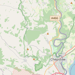

Current traffic around Pentrapeod
The following traffic incidents and congestion for Pentrapeod have been reported by Highways England, Traffic Scotland, Traffic Wales or Transport for London (TfL) in the last two hours:
J23A MAGOR TO J26 MALPAS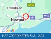 Description: M4WestboundJ23A (Magor) Magor to J26 (Newport) MalpasCongestionDelay: s possible :, Start time: 16/05/2025 18:34 , Expected end time: 16/05/2025 20:34, Severity: Moderate, Source: Welsh Government, Last updated: 16/05/2025 18:34
Nearest town: 12.63 miles from Pentrapeod. CLEARED @ 18:54TUA'R GORLLEWINDisgrifiad: M4Wedi clirioTuar GorllewinC23A Magwyr i G26 Malpas, Amser y digwyddiad: 16/05/2025 19:41 , Amser gorffen a ragwelir: 16/05/2025 19:46, Difrifoldeb: Cymedrol, Ffynhonnell: Llywodraeth Cymru, Diweddarwyd ddiwethaf: 16/05/2025 19:41
Nearest town: 12.63 miles from Pentrapeod.CEFN COED TO DOWLAIS TOP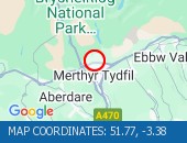 Description: A465Both directionsCefn Coed to Dowlais TopImprovement workRoad closedDiversions in place15/05/25-17/05/25 2000-0600 :, Start time: 15/05/2025 20:00 , End Date: 17/05/2025 6:00, Severity: Road closure, Source: Welsh Government, Last updated: 15/05/2025 20:00
Nearest town: 9.74 miles from Pentrapeod. CLEARED @ 18:18RAGLAN TO ABERGAVENNY HARDWICK R/BOUT Description: A40Both directionsRaglan to Abergavenny Hardwick R/boutResurfacing workRoad closedDiversions in place15/05/25-20/05/25 2000-0600 :, Start time: 15/05/2025 20:00 , End Date: 20/05/2025 6:00, Severity: Road closure, Source: Welsh Government, Last updated: 15/05/2025 20:00
Nearest town: 11.49 miles from Pentrapeod. CLEARED @ 17:30
Nearest town: 12.63 miles from Pentrapeod. CLEARED @ 18:54
Nearest town: 12.63 miles from Pentrapeod.
Nearest town: 9.74 miles from Pentrapeod. CLEARED @ 18:18
Nearest town: 11.49 miles from Pentrapeod. CLEARED @ 17:30
There are no current incidents in this location.


 National Highways England
 Transport for London (TFL)
 Traffic Wales
 Traffic Scotland
 YOUR AD HERE