Location: clockwise between junctions J9 (Leatherhead) and J10 (Guildford) .
Due to: Broken down vehicle.
Status : Cleared.
Nearest town: 11.94 miles from Nalderswood.

Cross Deep (All Directions) junction with Grotto Road.
All closures have been removed - Traffic flows have returned to normal in the area
Nearest town: 17.85 miles from Nalderswood.
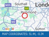
Leatherhead Road (Northbound).
Traffic is moving well.
Traffic is moving well.
Nearest town: 10.97 miles from Nalderswood.
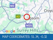
West Hill (westbound) between Keswick Road and Portinscale Road.
Partial lane one restriction.
All lanes have reopened on West Hill -Works are complete - Traffic flows have returned to normal
Nearest town: 18.24 miles from Nalderswood.
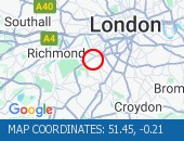
Sydenham Road (Both Directions) at the junction of Larkbere Road - Reports of an accident at this location.
Traffic is flowing well.
Nearest town: 18.49 miles from Nalderswood.
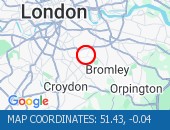
Clapham Common North Side (Eastbound) at the junction of Long Road .
Road reopened and traffic is moving well.
Nearest town: 19.14 miles from Nalderswood.
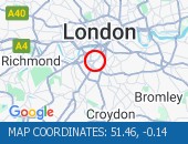
Clapham Road (Both Directions) at the junction of Lingham Street- there is a collision at this location.
Road reopened - accident cleared
Nearest town: 19.97 miles from Nalderswood.
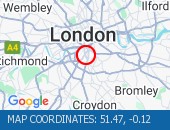
Dulwich Common (Both Directions) at the junction of Ryecotes Mead - All lanes are now open.
All lanes are now open.
Traffic is flowing well in the area.
Nearest town: 18.73 miles from Nalderswood.
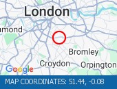
Burlington Road between High Street and Malden Way (Kingston By Pass) - road is closed due to a fire.
Traffic is flowing well.
Nearest town: 14.39 miles from Nalderswood.
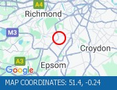
Dover House Road (Both Directions) at the junction of Upper Richmond Road - There will be stop / go boards in operation due to works in the area.
Works have now finished.
Nearest town: 18.9 miles from Nalderswood.
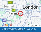
Tolworth Rise North (Northbound) - Lane restriction on on-slip to northbound A3 at the junction of Fairmead due to emergency gas works.
Restrictions have been removed.
All lanes open.
Nearest town: 13.28 miles from Nalderswood.
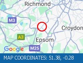
The Avenue (Southbound) at the junction of Windmill Drive - Lane one restrictions with single alternate lane traffic controlled by STOP / GO boards for BT works.
Traffic is flowing well in the area.
Nearest town: 18.69 miles from Nalderswood.
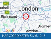
High Street (Both Directions) at the junction of Cambridge Road - 2-way temporary traffic signals in operation to facilitate new gas connection now removed.
Traffic is moving well.
Nearest town: 14.59 miles from Nalderswood.
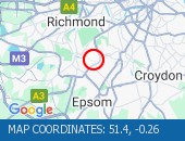
West Hill (Westbound) at the junction of Upper Richmond Road - Lane two blocked due to broken down van.
The broken down van has been recovered and traffic flows ahve returned to normal.
Nearest town: 18.43 miles from Nalderswood.
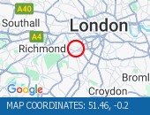
High Street (All Directions) at the junction of Homefield Rise - Temporary Traffic Signals to facilitate works Traffic is moving well.
Nearest town: 19.5 miles from Nalderswood.
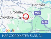
Bromley Common (Southbound) at the junction of Johnson Road - Road now reopened.
Traffic is moving well.
Nearest town: 18.19 miles from Nalderswood.
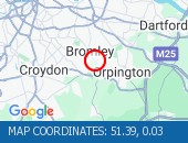
Battersea Park Road (Eastbound) at the junction of Battersea Bridge Road - Lane one is closed due to an emergency gas leak Traffic flows are normal for the time of day.
Nearest town: 19.73 miles from Nalderswood.
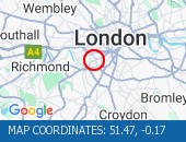
Norwood Road (Southbound) at the junction of Robson Road - Waterworks completed.
Traffic is moving well.
Nearest town: 17.77 miles from Nalderswood.
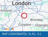
Trinity Road (Both Directions) at the junction of Eatonville Road - Temporary traffic signals will be in place to facilitate water works.
Nearest town: 17.44 miles from Nalderswood.
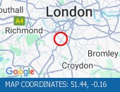
Purley Way (Northbound) between Whitestone Way and Commerce Way - Lane restrictions to facilitate carriageway chamber access works for new connections.
(Night works only)
Nearest town: 13.63 miles from Nalderswood.
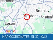
Sanderstead Hill (Both Directions) at the junction of Sundown Avenue - Possible lane closures because of a collision.
The road has reopened.
Nearest town: 12.22 miles from Nalderswood.
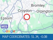
Nightingale Lane (Both Directions) between Bolingbroke Grove and Balham Hill - road closed to facilitate carriageway resurfacing.
Expect delays on approach.
Nearest town: 18.09 miles from Nalderswood.
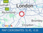
Battersea Rise (Eastbound) at the junction of St John's Road - Lane one closure in place to remove and build a bus shelter.
Nearest town: 18.97 miles from Nalderswood.
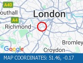
Bromley Common (Southbound) at the junction of Crown Lane - There is a collision at this location.
The southbound carriageway is blocked due a collision.
Police are directing traffic.
Expect delays
Nearest town: 18.24 miles from Nalderswood.
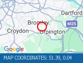
Balham Station Road (Both Directions) between Bedford Hill and Balham High Road - Road closed to facilitate carriageway resurfacing.
Use other routes.
Nearest town: 17.79 miles from Nalderswood.
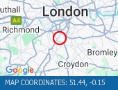
Purley Way (Northbound) between Whitestone Way and Commerce Way - Lane closure for BT works.
Nearest town: 13.75 miles from Nalderswood.

On Tolworth Broadway (Southbound) at the junction with A3 Tolworth Roundabout, there is a broken down vehicle blocking lane two of three).
Approach with caution.
All lanes have reopened.
Traffic is flowing well.
Nearest town: 13.12 miles from Nalderswood.

Greyhound Lane (Both Directions) at the junction of Streatham High Road - 2 way temporary traffic signals in operation to facilitate carriageway resurfacing.
Nearest town: 16.67 miles from Nalderswood.
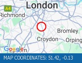
Beckenham Grove (Both Directions) between Scott's Lane and Shortlands Road - road closure to facilitate carriageway resurfacing.
Use other route.
Nearest town: 17.94 miles from Nalderswood.
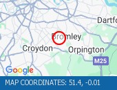
High Street (All Directions) at the junction of Grosvenor Road - two way temporary traffic signals will be in operation to facilitate gas works.
There are no restrictions in place at the present time.
Traffic is flowing normally.
Nearest town: 15.97 miles from Nalderswood.
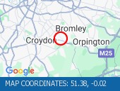
Middleton Road (Both Directions) between Bishopsford Road and St Helier Avenue - road closure to facilitate carriageway resurfacing.
Local diversion in place.
Nearest town: 13.98 miles from Nalderswood.
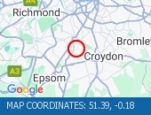
Bromley Road (All Directions) at the junction of Beckenham Hill Road - Temporary Traffic Signals in operation to facilitate works
Nearest town: 19.15 miles from Nalderswood.
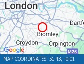
Farnborough Common (Both Directions) at the junction of Hilda Vale Road - Temporary signals in operation to facilitate resurfacing works.
Nearest town: 17.59 miles from Nalderswood.
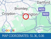
Lavender Hill (All Directions) at the junction of Falcon Road - Four-way temporary signals in operation to facilitate gully repairs.
Nearest town: 19.01 miles from Nalderswood.

Location: clockwise exit slip at junction J10 (Guildford) .
Due to: Congestion.
Normal traffic conditions are expected between 15:30 and 15:45 on 18 March 2025.
Delay : There are currently delays of 10 minutes against expected traffic.
Nearest town: 12.65 miles from Nalderswood.
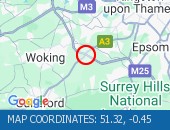
Location: clockwise exit slip at junction J10 (Guildford) .
Due to: Congestion.
Normal traffic conditions are expected between 14:45 and 15:00 on 18 March 2025.
Delay : There are currently delays of 10 minutes against expected traffic.
Nearest town: 12.65 miles from Nalderswood.

Location: southbound exit slip to the M25 .
Due to: Congestion.
Normal traffic conditions are expected between 13:30 and 13:45 on 18 March 2025.
Nearest town: 12.82 miles from Nalderswood.

Location: clockwise exit slip at junction J10 (Guildford) .
Due to: Congestion.
Normal traffic conditions are expected between 13:30 and 13:45 on 18 March 2025.
Nearest town: 12.65 miles from Nalderswood.

Location: clockwise between junctions J9 (Leatherhead) and J10 (Guildford) .
Due to: Congestion.
Normal traffic conditions are expected between 13:30 and 13:45 on 18 March 2025.
Delay : There are currently delays of 10 minutes against expected traffic.
Earlier
Due to: Caused by the earlier broken down vehicle.
Nearest town: 12.65 miles from Nalderswood.

Location: clockwise exit slip at junction J10 (Guildford) .
Due to: Congestion.
Normal traffic conditions are expected between 10:15 and 10:30 on 18 March 2025.
Nearest town: 12.65 miles from Nalderswood.

Location: anticlockwise between junctions J6 (East Grinstead) and J5 (Sevenoaks) .
Lane Closures : Lanes 1, 2 and 3 will be closed.
Due to: Roadworks are planned.
Status : Pending.
Schedule : From 22:00 on 18 March 2025 to 05:30 on 19 March 2025.
Lanes Closed : There will be three of four lanes closed.
Nearest town: 15.23 miles from Nalderswood.
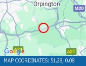
Location: eastbound between junctions J3 (Woking) and J2 (Gatwick M23) .
Lane Closures : Lanes 1 and 2 will be closed.
Due to: Roadworks are planned.
Status : Pending.
Schedule : Expect disruption everyday between 22:00 and 05:30 from 18 March 2025 to 21 March 2025.
Lanes Closed : There will be two of four lanes closed.
Nearest town: 19.63 miles from Nalderswood.
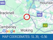
Location: southbound between the A244 and the junction with the A247 .
Due to: Roadworks scheme.
Period : from 22:01 on 17 March 2025 to 05:30 on 21 March 2025.
Nearest town: 12.61 miles from Nalderswood.
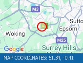
Location: eastbound between junctions J3 (Woking) and J2 (Gatwick M23) .
Due to: Roadworks scheme is planned.
Status : Pending.
Schedule : From 22:00 on 18 March 2025 to 05:30 on 21 March 2025.
Nearest town: 19.63 miles from Nalderswood.

Location: southbound.
Due to: Roadworks are planned.
Status : Pending.
Schedule : From 21:00 on 18 March 2025 to 06:00 on 19 March 2025.
Lanes Closed : All lanes will be closed.
Nearest town: 3.6 miles from Nalderswood.
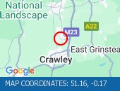
Location: southbound.
Due to: Roadworks are planned.
Status : Pending.
Schedule : From 21:00 on 18 March 2025 to 06:00 on 19 March 2025.
Lanes Closed : All lanes will be closed.
Nearest town: 3.73 miles from Nalderswood.

Location: northbound between junctions J11 (Brighton) and J10A (Crawley) .
Due to: Roadworks scheme.
Period : from 20:07 on 17 March 2025 to 06:00 on 12 December 2025.
Nearest town: 7.42 miles from Nalderswood.
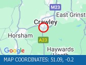
Location: southbound between the junctions with the M23 and the A272 .
Due to: Roadworks scheme.
Period : from 20:07 on 17 March 2025 to 06:00 on 16 December 2025.
Nearest town: 7.61 miles from Nalderswood.
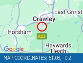
Location: westbound between junctions J2 (Gatwick M23) and J3 (Woking) .
Lane Closures : Lane one is closed.
Due to: Roadworks.
Period : expect disruption until 06:00 on 1 May 2025.
Lanes Closed : There is one of four lanes closed.
Nearest town: 19.88 miles from Nalderswood.
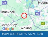
Location: northbound entry slip from the A2300 .
Due to: Roadworks scheme.
Period : from 20:03 on 3 March 2025 to 06:00 on 16 May 2025.
Nearest town: 15.53 miles from Nalderswood.
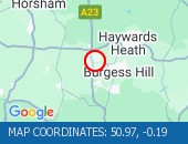
Location: northbound.
Due to: Roadworks scheme is planned.
Status : Pending.
Schedule : From 21:00 on 18 March 2025 to 06:00 on 3 April 2025.
Nearest town: 3.56 miles from Nalderswood.

Location: The junction of the A23 and the M23 .
Due to: Roadworks scheme is planned.
Status : Pending.
Schedule : From 21:00 on 18 March 2025 to 06:00 on 3 April 2025.
Nearest town: 3.73 miles from Nalderswood.

Location: westbound between junction J2A and the M25 .
Lane Closures : The hard shoulder and lane 1 are closed.
Due to: Road repairs.
Period : expect disruption until 05:30 on 31 March 2025.
Lanes Closed : There is one of two lanes closed.
Nearest town: 18.49 miles from Nalderswood.
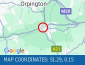
Location: clockwise between junctions J5 (Sevenoaks) and J6 (East Grinstead) .
Lane Closures : The hard shoulder and lane 1 are closed.
Due to: Road repairs.
Period : expect disruption until 05:30 on 31 March 2025.
Lanes Closed : There is one of four lanes closed.
Nearest town: 18.1 miles from Nalderswood.
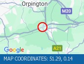
Location: anticlockwise between junctions J6 (East Grinstead) and J5 (Sevenoaks) .
Lane Closures : Lane one is closed.
Due to: Road repairs.
Period : expect disruption until 05:30 on 31 March 2025.
Lanes Closed : There is one of four lanes closed.
Nearest town: 9.3 miles from Nalderswood.
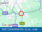
Location: westbound between junctions J2 (Gatwick M23) and J4A (Farnborough) .
Due to: Roadworks scheme.
Period : from 23:00 on 29 April 2024 to 06:00 on 1 May 2025.
Nearest town: 19.88 miles from Nalderswood.

Location: clockwise between junctions J10 (Guildford) and J11 (Chertsey) .
Due to: Roadworks scheme.
Period : from 23:59 on 31 December 2023 to 23:59 on 31 May 2025.
Nearest town: 12.53 miles from Nalderswood.
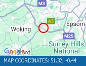
Location: clockwise between junctions J10 (Guildford) and J11 (Chertsey) .
Lane Closures : The hard shoulder is closed.
Due to: Roadworks.
Period : expect disruption until 23:59 on 31 May 2025.
Nearest town: 13.23 miles from Nalderswood.
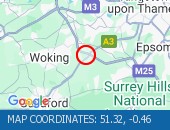
Location: anticlockwise between junctions J10 (Guildford) and J9 (Leatherhead) .
Due to: Roadworks scheme.
Period : from 00:02 on 1 January 2024 to 23:59 on 31 May 2025.
Nearest town: 13.05 miles from Nalderswood.

Location: anticlockwise between junctions J10 (Guildford) and J9 (Leatherhead) .
Lane Closures : The hard shoulder is closed.
Due to: Roadworks.
Period : expect disruption until 23:59 on 31 May 2025.
Nearest town: 12.27 miles from Nalderswood.

Location: clockwise at junction J10 (Guildford) .
Lane Closures : The hard shoulder is closed.
Due to: Roadworks.
Period : expect disruption until 23:59 on 31 May 2025.
Nearest town: 12.53 miles from Nalderswood.

Location: anticlockwise at junction J10 (Guildford) .
Lane Closures : The hard shoulder is closed.
Due to: Roadworks.
Period : expect disruption until 23:59 on 31 May 2025.
Nearest town: 13.05 miles from Nalderswood.

Location: southbound between the A245 and the junction with the M25 .
Lane Closures : The hard shoulder is closed.
Due to: Roadworks.
Period : expect disruption until 23:59 on 31 May 2025.
Nearest town: 12.78 miles from Nalderswood.
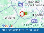
Location: westbound between junctions J2 (Gatwick M23) and J3 (Woking) .
Lane Closures : Lanes 3 and 4 will be closed.
Due to: Roadworks are planned.
Status : Pending.
Schedule : From 20:00 on 19 March 2025 to 06:00 on 20 March 2025.
Lanes Closed : There will be two of four lanes closed.
Nearest town: 19.78 miles from Nalderswood.
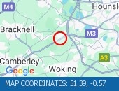
Location: anticlockwise between junctions J10 (Guildford) and J9 (Leatherhead) .
Lane Closures : Lanes 2, 3 and 4 will be closed.
Due to: Roadworks are planned.
Status : Pending.
Schedule : Expect disruption everyday between 22:00 and 05:00 from 18 March 2025 to 20 March 2025.
Lanes Closed : There will be three of four lanes closed.
Nearest town: 9.97 miles from Nalderswood.
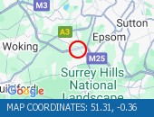
Location: anticlockwise between junctions J10 (Guildford) and J9 (Leatherhead) .
Lane Closures : Lanes 2, 3 and 4 will be closed.
Due to: Roadworks are planned.
Status : Pending.
Schedule : Expect disruption everyday between 22:00 and 05:30 from 24 March 2025 to 28 March 2025.
Lanes Closed : There will be three of four lanes closed.
Nearest town: 10.33 miles from Nalderswood.
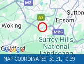
Location: clockwise between junctions J9 (Leatherhead) and J10 (Guildford) .
Lane Closures : Lanes 2, 3 and 4 will be closed.
Due to: Roadworks are planned.
Status : Pending.
Schedule : Expect disruption everyday between 22:00 and 05:30 from 24 March 2025 to 28 March 2025.
Lanes Closed : There will be three of four lanes closed.
Nearest town: 9.73 miles from Nalderswood.
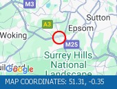
Location: clockwise at junction J6 (East Grinstead) .
Lane Closures : Lanes 1 and 2 will be closed.
Due to: Horticultural works are planned.
Status : Pending.
Schedule : Expect disruption everyday between 22:00 and 05:30 from 24 March 2025 to 28 March 2025.
Lanes Closed : There will be two of three lanes closed.
Nearest town: 9.19 miles from Nalderswood.

Location: clockwise entry slip at junction J6 (East Grinstead) .
Lane Closures : Lane one will be closed.
Due to: Horticultural works are planned.
Status : Pending.
Schedule : Expect disruption everyday between 22:00 and 05:30 from 24 March 2025 to 28 March 2025.
Lanes Closed : There will be one of two lanes closed.
Nearest town: 8.91 miles from Nalderswood.
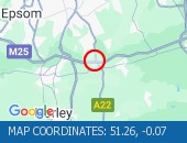
Location: clockwise between junctions J5 (Sevenoaks) and J6 (East Grinstead) .
Lane Closures : Lanes 1 and 2 will be closed.
Due to: Horticultural works are planned.
Status : Pending.
Schedule : Expect disruption everyday between 22:00 and 05:30 from 24 March 2025 to 28 March 2025.
Lanes Closed : There will be two of four lanes closed.
Nearest town: 11 miles from Nalderswood.
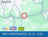
Location: anticlockwise entry slip at junction J7 (Gatwick) from the M23 north.
Lane Closures : Lanes 1 and 2 will be closed.
Due to: Road repairs are planned.
Status : Pending.
Schedule : Expect disruption everyday between 22:00 and 05:30 from 24 March 2025 to 27 March 2025.
Lanes Closed : All lanes will be closed.
Nearest town: 6.93 miles from Nalderswood.
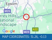
Location: anticlockwise entry slip at junction J7 (Gatwick) from the M23 south.
Lane Closures : Lanes 1 and 2 will be closed.
Due to: Road repairs are planned.
Status : Pending.
Schedule : Expect disruption everyday between 22:00 and 05:30 from 24 March 2025 to 27 March 2025.
Lanes Closed : All lanes will be closed.
Nearest town: 7.17 miles from Nalderswood.
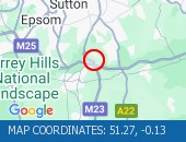
Location: clockwise between junctions J6 (East Grinstead) and J7 (Gatwick) .
Lane Closures : Lanes 1 and 2 will be closed.
Due to: Horticultural works are planned.
Status : Pending.
Schedule : Expect disruption everyday between 22:00 and 05:30 from 24 March 2025 to 28 March 2025.
Lanes Closed : There will be two of four lanes closed.
Nearest town: 8.49 miles from Nalderswood.
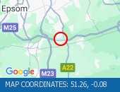
Location: anticlockwise between junctions J6 (East Grinstead) and J5 (Sevenoaks) .
Lane Closures : Lanes 1 and 2 will be closed.
Due to: Roadworks are planned.
Status : Pending.
Schedule : From 22:00 on 24 March 2025 to 05:30 on 25 March 2025.
Schedule : From 22:00 on 26 March 2025 to 05:30 on 27 March 2025.
Schedule : From 23:00 on 28 March 2025 to 06:00 on 29 March 2025.
Schedule : Expect disruption everyday between 22:00 and 05:30 from 31 March 2025 to 2 April 2025.
Lanes Closed : There will be two of four lanes closed.
Nearest town: 11.87 miles from Nalderswood.
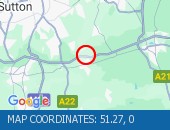
Location: anticlockwise between junctions J9 (Leatherhead) and J8 (Reigate) .
Lane Closures : Lanes 2, 3 and 4 will be closed.
Due to: Road repairs are planned.
Status : Pending.
Schedule : Expect disruption everyday between 22:00 and 05:30 from 24 March 2025 to 28 March 2025.
Lanes Closed : There will be three of four lanes closed.
Nearest town: 6 miles from Nalderswood.
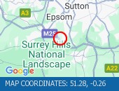
Location: clockwise between junctions J10 (Guildford) and J11 (Chertsey) .
Lane Closures : Lanes 1, 2 and 3 will be closed.
Due to: Road repairs are planned.
Status : Pending.
Schedule : Expect disruption everyday between 22:00 and 05:30 from 25 March 2025 to 27 March 2025.
Lanes Closed : All lanes will be closed.
Nearest town: 12.62 miles from Nalderswood.

Location: northbound between the junctions with the A244 and the A309 .
Lane Closures : Lane one will be closed.
Due to: Roadworks are planned.
Status : Pending.
Schedule : From 22:00 on 24 March 2025 to 05:00 on 25 March 2025.
Lanes Closed : There will be one of two lanes closed.
Nearest town: 12.67 miles from Nalderswood.
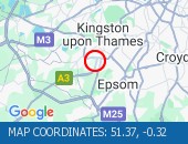
Location: westbound between junctions J2 (Gatwick M23) from M25 anti-clockwise and J3 (Woking) .
Due to: Roadworks scheme is planned.
Status : Pending.
Schedule : From 22:00 on 24 March 2025 to 05:30 on 2 April 2025.
Nearest town: 19.36 miles from Nalderswood.
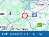
Location: westbound between junctions J2 (Gatwick M23) from M25 anti-clockwise and J3 (Woking) .
Lane Closures : Lanes 1 and 2 will be closed.
Due to: Roadworks are planned.
Status : Pending.
Schedule : Expect disruption everyday between 22:00 and 05:30 from 24 March 2025 to 26 March 2025.
Schedule : Expect disruption everyday between 22:00 and 05:30 from 31 March 2025 to 2 April 2025.
Lanes Closed : All lanes will be closed.
Nearest town: 19.36 miles from Nalderswood.

Location: westbound entry slip at junction J2 (Gatwick M23) from M25 clockwise.
Lane Closures : Lanes 1 and 2 will be closed.
Due to: Roadworks are planned.
Status : Pending.
Schedule : Expect disruption everyday between 22:00 and 05:30 from 24 March 2025 to 26 March 2025.
Schedule : Expect disruption everyday between 22:00 and 05:30 from 31 March 2025 to 2 April 2025.
Lanes Closed : All lanes will be closed.
Nearest town: 19.29 miles from Nalderswood.

Location: westbound at junction J2 (Gatwick M23) .
Lane Closures : Lanes 1 and 2 will be closed.
Due to: Roadworks are planned.
Status : Pending.
Schedule : Expect disruption everyday between 22:00 and 05:30 from 24 March 2025 to 26 March 2025.
Schedule : Expect disruption everyday between 22:00 and 05:30 from 31 March 2025 to 2 April 2025.
Lanes Closed : All lanes will be closed.
Nearest town: 19.16 miles from Nalderswood.
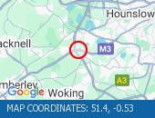
Location: anticlockwise between junctions J11 (Chertsey) and J10 (Guildford) .
Lane Closures : Lane four will be closed.
Due to: Road repairs are planned.
Status : Pending.
Schedule : Expect disruption everyday between 22:00 and 05:30 from 24 March 2025 to 28 March 2025.
Lanes Closed : There will be one of four lanes closed.
Nearest town: 16.36 miles from Nalderswood.
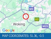
Location: clockwise entry slip at junction J10 (Guildford) .
Due to: Road repairs are planned.
Status : Pending.
Schedule : Expect disruption everyday between 22:00 and 05:30 from 25 March 2025 to 27 March 2025.
Lanes Closed : All lanes will be closed.
Nearest town: 12.84 miles from Nalderswood.

Location: northbound between the junctions with the A247 and the M25 .
Lane Closures : Lane one will be closed.
Due to: Road repairs are planned.
Status : Pending.
Schedule : Expect disruption everyday between 22:00 and 05:30 from 25 March 2025 to 27 March 2025.
Lanes Closed : There will be one of three lanes closed.
Nearest town: 12.8 miles from Nalderswood.
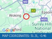
Location: clockwise at junction J10 (Guildford) .
Lane Closures : Lanes 2 and 3 will be closed.
Due to: Road repairs are planned.
Status : Pending.
Schedule : Expect disruption everyday between 22:00 and 05:30 from 25 March 2025 to 27 March 2025.
Lanes Closed : There will be two of three lanes closed.
Nearest town: 12.53 miles from Nalderswood.

Location: northbound between junctions J8 (Reigate) and J7 (Crawley) .
Lane Closures : Lane one will be closed.
Due to: Road repairs are planned.
Status : Pending.
Schedule : Expect disruption everyday between 22:00 and 05:30 from 24 March 2025 to 28 March 2025.
Schedule : From 23:00 on 28 March 2025 to 06:00 on 29 March 2025.
Lanes Closed : There will be one of three lanes closed.
Nearest town: 6.95 miles from Nalderswood.
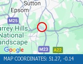
Location: northbound between the A244 and the junction with the A309 .
Lane Closures : Lane one will be closed.
Due to: Roadworks are planned.
Status : Pending.
Schedule : From 22:00 on 24 March 2025 to 05:00 on 25 March 2025.
Lanes Closed : There will be one of three lanes closed.
Nearest town: 12.2 miles from Nalderswood.
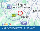
Location: northbound exit slip to the M25 .
Due to: Road repairs are planned.
Status : Pending.
Schedule : Expect disruption everyday between 22:00 and 05:30 from 25 March 2025 to 27 March 2025.
Lanes Closed : All lanes will be closed.
Nearest town: 12.75 miles from Nalderswood.

Location: northbound at the junction with the M25 .
Lane Closures : Lane one will be closed.
Due to: Road repairs are planned.
Status : Pending.
Schedule : Expect disruption everyday between 22:00 and 05:30 from 25 March 2025 to 27 March 2025.
Lanes Closed : There will be one of two lanes closed.
Nearest town: 12.75 miles from Nalderswood.

Location: northbound between junctions J8 (Reigate) and J7 (Crawley) .
Lane Closures : Lane one will be closed.
Due to: Road repairs are planned.
Status : Pending.
Schedule : Expect disruption everyday between 22:00 and 05:30 from 24 March 2025 to 28 March 2025.
Schedule : From 23:00 on 28 March 2025 to 06:00 on 29 March 2025.
Lanes Closed : There will be one of two lanes closed.
Nearest town: 6.93 miles from Nalderswood.
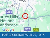
Location: clockwise at junction J11 (Chertsey) .
Lane Closures : Lanes 1, 2 and 3 will be closed.
Due to: Road repairs are planned.
Status : Pending.
Schedule : From 22:00 on 24 March 2025 to 05:30 on 25 March 2025.
Schedule : From 22:00 on 27 March 2025 to 05:30 on 28 March 2025.
Lanes Closed : All lanes will be closed.
Nearest town: 16.95 miles from Nalderswood.
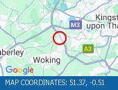
Location: clockwise between junctions J10 (Guildford) and J11 (Chertsey) .
Lane Closures : Lanes 1, 2 and 3 will be closed.
Due to: Road repairs are planned.
Status : Pending.
Schedule : From 22:00 on 24 March 2025 to 05:30 on 25 March 2025.
Schedule : From 22:00 on 27 March 2025 to 05:30 on 28 March 2025.
Lanes Closed : There will be three of four lanes closed.
Nearest town: 15.87 miles from Nalderswood.
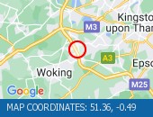
Location: southbound between the A2300 and the junction with the A273 .
Lane Closures : Lane one will be closed.
Due to: Roadworks are planned.
Status : Pending.
Schedule : From 20:00 on 24 March 2025 to 06:00 on 25 March 2025.
Lanes Closed : There will be one of two lanes closed.
Nearest town: 19.85 miles from Nalderswood.
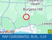
Location: southbound.
Due to: Roadworks are planned.
Status : Pending.
Schedule : From 21:00 on 24 March 2025 to 06:00 on 25 March 2025.
Lanes Closed : All lanes will be closed.
Nearest town: 15.79 miles from Nalderswood.
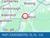
Location: southbound.
Due to: Roadworks are planned.
Status : Pending.
Schedule : From 20:00 on 24 March 2025 to 06:00 on 25 March 2025.
Lanes Closed : All lanes will be closed.
Nearest town: 19.76 miles from Nalderswood.

Location: southbound between the A2300 and the junction with the A281 .
Lane Closures : Lane one will be closed.
Due to: Roadworks are planned.
Status : Pending.
Schedule : From 20:00 on 24 March 2025 to 06:00 on 25 March 2025.
Lanes Closed : There will be one of two lanes closed.
Nearest town: 19.05 miles from Nalderswood.
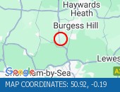
Location: southbound.
Due to: Roadworks are planned.
Status : Pending.
Schedule : From 20:00 on 24 March 2025 to 06:00 on 25 March 2025.
Lanes Closed : All lanes will be closed.
Nearest town: 19.65 miles from Nalderswood.

Location: clockwise between junctions J10 (Guildford) and J11 (Chertsey) .
Lane Closures : Lanes 1, 2, 3 and 4 will be closed.
Due to: Roadworks are planned.
Status : Pending.
Schedule : From 21:00 on 21 March 2025 to 05:30 on 24 March 2025.
Lanes Closed : All lanes will be closed.
Nearest town: 13.19 miles from Nalderswood.

Location: anticlockwise between junctions J11 (Chertsey) and J10 (Guildford) .
Lane Closures : Lanes 1, 2, 3 and 4 will be closed.
Due to: Roadworks are planned.
Status : Pending.
Schedule : From 21:00 on 21 March 2025 to 05:30 on 24 March 2025.
Lanes Closed : All lanes will be closed.
Nearest town: 16.62 miles from Nalderswood.
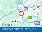
Location: clockwise between junctions J9 (Leatherhead) and J10 (Guildford) .
Lane Closures : Lanes 1, 2 and 3 will be closed.
Due to: Road repairs are planned.
Status : Pending.
Schedule : Expect disruption everyday between 22:00 and 05:30 from 18 March 2025 to 21 March 2025.
Lanes Closed : There will be three of four lanes closed.
Nearest town: 9.7 miles from Nalderswood.
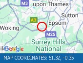
Location: clockwise between junctions J9 (Leatherhead) and J10 (Guildford) .
Due to: Horticultural works are planned.
Status : Pending.
Schedule : Expect disruption everyday between 09:30 and 16:00 from 24 March 2025 to 27 March 2025.
Nearest town: 9.8 miles from Nalderswood.

Location: clockwise between junctions J4 (Bromley) and J5 (Sevenoaks) .
Due to: Barrier repairs are planned.
Status : Pending.
Schedule : From 09:30 on 24 March 2025 to 16:00 on 24 March 2025.
Nearest town: 18.92 miles from Nalderswood.
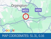
Location: The junction of the A23 and the M23 .
Lane Closures : Lane one will be closed.
Due to: Roadworks are planned.
Status : Pending.
Schedule : From 21:00 on 27 March 2025 to 06:00 on 28 March 2025.
Schedule : Expect disruption everyday between 21:00 and 06:00 from 31 March 2025 to 3 April 2025.
Lanes Closed : There will be one of three lanes closed.
Nearest town: 4.38 miles from Nalderswood.
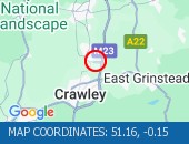
Location: The junction of the A23 and the M23 .
Lane Closures : Lane one will be closed.
Due to: Roadworks are planned.
Status : Pending.
Schedule : From 21:00 on 27 March 2025 to 06:00 on 28 March 2025.
Schedule : Expect disruption everyday between 21:00 and 06:00 from 31 March 2025 to 3 April 2025.
Lanes Closed : There will be one of three lanes closed.
Nearest town: 4.32 miles from Nalderswood.
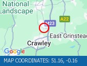
Location: southbound between the A225 and the junction with the A26 .
Lane Closures : Lane two will be closed.
Due to: Barrier repairs are planned.
Status : Pending.
Schedule : Expect disruption everyday between 20:00 and 06:00 from 22 March 2025 to 24 March 2025.
Lanes Closed : There will be one of two lanes closed.
Nearest town: 19.73 miles from Nalderswood.
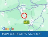
Location: northbound between the junctions with the A244 and the A309 .
Lane Closures : Lane one will be closed.
Due to: Roadworks are planned.
Status : Pending.
Schedule : From 23:00 on 21 March 2025 to 06:00 on 22 March 2025.
Schedule : From 22:00 on 24 March 2025 to 05:30 on 25 March 2025.
Lanes Closed : There will be one of two lanes closed.
Nearest town: 12.67 miles from Nalderswood.

Location: anticlockwise entry slip at junction J6 (East Grinstead) .
Due to: Roadworks are planned.
Status : Pending.
Schedule : From 23:00 on 21 March 2025 to 06:00 on 22 March 2025.
Lanes Closed : All lanes will be closed.
Nearest town: 9.05 miles from Nalderswood.

Location: northbound between the A244 and the junction with the A309 .
Lane Closures : Lane one will be closed.
Due to: Roadworks are planned.
Status : Pending.
Schedule : From 23:00 on 21 March 2025 to 06:00 on 22 March 2025.
Schedule : From 22:00 on 24 March 2025 to 05:30 on 25 March 2025.
Lanes Closed : There will be one of three lanes closed.
Nearest town: 12.41 miles from Nalderswood.

Location: anticlockwise between junctions J8 (Reigate) and J7 (Gatwick) .
Lane Closures : Lanes 3 and 4 will be closed.
Due to: Roadworks are planned.
Status : Pending.
Schedule : From 23:00 on 21 March 2025 to 05:00 on 22 March 2025.
Lanes Closed : There will be two of four lanes closed.
Nearest town: 6.25 miles from Nalderswood.
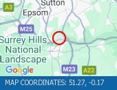
Location: anticlockwise between junctions J6 (East Grinstead) and J5 (Sevenoaks) .
Due to: Roadworks are planned.
Status : Pending.
Schedule : From 22:00 on 20 March 2025 to 05:30 on 21 March 2025.
Lanes Closed : All lanes will be closed.
Nearest town: 9.27 miles from Nalderswood.

Location: westbound between junctions J2 (Gatwick M23) and J3 (Woking) .
Lane Closures : Lanes 3 and 4 will be closed.
Due to: Roadworks are planned.
Status : Pending.
Schedule : From 20:00 on 19 March 2025 to 06:00 on 20 March 2025.
Lanes Closed : There will be two of four lanes closed.
Nearest town: 19.78 miles from Nalderswood.

Location: anticlockwise between junctions J5 (Sevenoaks) and J4 (Bromley) .
Lane Closures : Lane one will be closed.
Due to: Horticultural works are planned.
Status : Pending.
Schedule : From 22:30 on 20 March 2025 to 05:30 on 21 March 2025.
Lanes Closed : There will be one of three lanes closed.
Nearest town: 19.7 miles from Nalderswood.
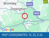
Location: eastbound between junctions A224 and M25 .
Lane Closures : Lane one will be closed.
Due to: Roadworks are planned.
Status : Pending.
Schedule : From 22:00 on 20 March 2025 to 05:30 on 21 March 2025.
Lanes Closed : There will be one of two lanes closed.
Nearest town: 19.97 miles from Nalderswood.
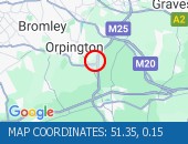
Location: anticlockwise between junctions J5 (Sevenoaks) and J4 (Bromley) .
Lane Closures : Lane one will be closed.
Due to: Roadworks are planned.
Status : Pending.
Schedule : From 22:00 on 20 March 2025 to 05:30 on 21 March 2025.
Lanes Closed : There will be one of three lanes closed.
Nearest town: 19.89 miles from Nalderswood.
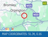
Location: clockwise between junctions J4 (Bromley) and J5 (Sevenoaks) .
Lane Closures : The hard shoulder is closed.
Due to: Emergency barrier repairs.
Period : expect disruption until 16:00 on 18 March 2025.
Nearest town: 19.76 miles from Nalderswood.

Location: clockwise between junctions J5 (Sevenoaks) and J5 (Sevenoaks) .
Due to: Roadworks scheme is planned.
Status : Pending.
Schedule : From 22:00 on 19 March 2025 to 06:00 on 20 March 2025.
Nearest town: 17.9 miles from Nalderswood.

Location: clockwise entry slip at junction J5 (Sevenoaks) .
Lane Closures : Lanes 1 and 2 will be closed.
Due to: Roadworks are planned.
Status : Pending.
Schedule : From 22:00 on 19 March 2025 to 06:00 on 20 March 2025.
Lanes Closed : All lanes will be closed.
Nearest town: 17.9 miles from Nalderswood.

Location: anticlockwise at junction J12 (Basingstoke) .
Lane Closures : Lanes 1 and 2 will be closed.
Due to: Roadworks are planned.
Status : Pending.
Schedule : Expect disruption everyday between 22:00 and 05:30 from 19 March 2025 to 21 March 2025.
Lanes Closed : There will be two of three lanes closed.
Nearest town: 19.56 miles from Nalderswood.

Location: clockwise between junctions J5 (Sevenoaks) and J6 (East Grinstead) .
Lane Closures : Lanes 1 and 2 will be closed.
Due to: Roadworks are planned.
Status : Pending.
Schedule : From 22:00 on 19 March 2025 to 06:00 on 20 March 2025.
Lanes Closed : All lanes will be closed.
Nearest town: 18.5 miles from Nalderswood.
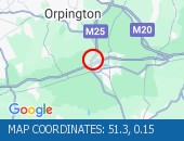
Location: anticlockwise between junctions J6 (East Grinstead) and J5 (Sevenoaks) .
Lane Closures : Lanes 1, 2 and 3 will be closed.
Due to: Roadside drains works are planned.
Status : Pending.
Schedule : Expect disruption everyday between 22:00 and 05:30 from 18 March 2025 to 20 March 2025.
Lanes Closed : There will be three of four lanes closed.
Nearest town: 11.57 miles from Nalderswood.

Location: anticlockwise between junctions J10 (Guildford) and J9 (Leatherhead) .
Lane Closures : Lanes 2, 3 and 4 will be closed.
Due to: Litter clearance is planned.
Status : Pending.
Schedule : Expect disruption everyday between 22:00 and 05:00 from 18 March 2025 to 20 March 2025.
Lanes Closed : There will be three of four lanes closed.
Nearest town: 9.73 miles from Nalderswood.

Location: anticlockwise between junctions J9 (Leatherhead) and J8 (Reigate) .
Lane Closures : Lanes 1, 2, 3 and 4 will be closed.
Due to: Litter clearance is planned.
Status : Pending.
Schedule : Expect disruption everyday between 22:00 and 05:00 from 18 March 2025 to 20 March 2025.
Lanes Closed : All lanes will be closed.
Nearest town: 9.55 miles from Nalderswood.
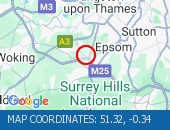
Location: anticlockwise entry slip at junction J9 (Leatherhead) .
Lane Closures : Lane one will be closed.
Due to: Litter clearance is planned.
Status : Pending.
Schedule : Expect disruption everyday between 22:00 and 05:00 from 18 March 2025 to 20 March 2025.
Lanes Closed : All lanes will be closed.
Nearest town: 9.4 miles from Nalderswood.
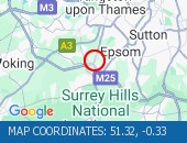
Location: anticlockwise exit slip at junction J8 (Reigate) .
Due to: Litter clearance is planned.
Status : Pending.
Schedule : Expect disruption everyday between 22:00 and 05:00 from 18 March 2025 to 20 March 2025.
Lanes Closed : All lanes will be closed.
Nearest town: 4.93 miles from Nalderswood.
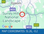
Location: northbound.
Due to: Roadworks are planned.
Status : Pending.
Schedule : Expect disruption everyday between 21:00 and 06:00 from 14 April 2025 to 17 April 2025.
Schedule : Expect disruption everyday between 21:00 and 06:00 from 23 April 2025 to 26 April 2025.
Lanes Closed : All lanes will be closed.
Nearest town: 17.58 miles from Nalderswood.
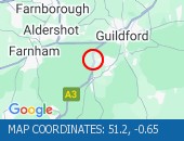
Location: northbound.
Due to: Roadworks are planned.
Status : Pending.
Schedule : Expect disruption everyday between 21:00 and 06:00 from 14 April 2025 to 17 April 2025.
Schedule : Expect disruption everyday between 21:00 and 06:00 from 23 April 2025 to 26 April 2025.
Lanes Closed : All lanes will be closed.
Nearest town: 17.56 miles from Nalderswood.

Location: southbound.
Due to: Roadworks are planned.
Status : Pending.
Schedule : Expect disruption everyday between 21:00 and 06:00 from 7 April 2025 to 12 April 2025.
Lanes Closed : All lanes will be closed.
Nearest town: 17.52 miles from Nalderswood.

Location: southbound.
Due to: Roadworks are planned.
Status : Pending.
Schedule : Expect disruption everyday between 21:00 and 06:00 from 7 April 2025 to 12 April 2025.
Lanes Closed : All lanes will be closed.
Nearest town: 17.06 miles from Nalderswood.
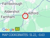
Location: southbound between the A31 and the junction with the A283 Godalming North.
Due to: Roadworks are planned.
Status : Pending.
Schedule : Expect disruption everyday between 21:00 and 06:00 from 7 April 2025 to 12 April 2025.
Lanes Closed : All lanes will be closed.
Nearest town: 16.53 miles from Nalderswood.
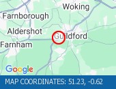
Location: northbound.
Due to: Roadworks are planned.
Status : Pending.
Schedule : Expect disruption everyday between 21:00 and 06:00 from 14 April 2025 to 17 April 2025.
Schedule : Expect disruption everyday between 21:00 and 06:00 from 23 April 2025 to 26 April 2025.
Lanes Closed : All lanes will be closed.
Nearest town: 17.6 miles from Nalderswood.
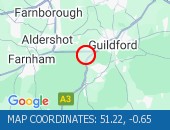
Location: northbound entry slip from the A283 .
Due to: Roadworks are planned.
Status : Pending.
Schedule : Expect disruption everyday between 21:00 and 06:00 from 14 April 2025 to 17 April 2025.
Schedule : Expect disruption everyday between 21:00 and 06:00 from 23 April 2025 to 26 April 2025.
Lanes Closed : All lanes will be closed.
Nearest town: 17.89 miles from Nalderswood.
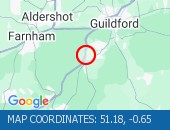
Location: southbound exit slip to the A283 .
Due to: Roadworks are planned.
Status : Pending.
Schedule : Expect disruption everyday between 21:00 and 06:00 from 7 April 2025 to 12 April 2025.
Lanes Closed : All lanes will be closed.
Nearest town: 17.75 miles from Nalderswood.

Location: southbound.
Due to: Roadworks are planned.
Status : Pending.
Schedule : Expect disruption everyday between 21:00 and 06:00 from 7 April 2025 to 12 April 2025.
Lanes Closed : All lanes will be closed.
Nearest town: 17.44 miles from Nalderswood.
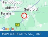
Location: northbound between the A333 and the junction with the A31 .
Due to: Roadworks are planned.
Status : Pending.
Schedule : Expect disruption everyday between 21:00 and 06:00 from 14 April 2025 to 17 April 2025.
Schedule : Expect disruption everyday between 21:00 and 06:00 from 23 April 2025 to 26 April 2025.
Lanes Closed : All lanes will be closed.
Nearest town: 18.05 miles from Nalderswood.
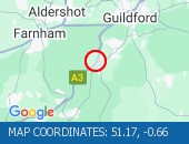
Location: northbound.
Due to: Roadworks are planned.
Status : Pending.
Schedule : Expect disruption everyday between 21:00 and 06:00 from 14 April 2025 to 17 April 2025.
Schedule : Expect disruption everyday between 21:00 and 06:00 from 23 April 2025 to 26 April 2025.
Lanes Closed : All lanes will be closed.
Nearest town: 17.56 miles from Nalderswood.
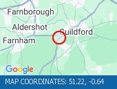
Location: southbound.
Due to: Roadworks are planned.
Status : Pending.
Schedule : Expect disruption everyday between 21:00 and 06:00 from 7 April 2025 to 12 April 2025.
Lanes Closed : All lanes will be closed.
Nearest town: 17.51 miles from Nalderswood.

Location: northbound exit slip to the A245 .
Due to: Roadworks are planned.
Status : Pending.
Schedule : Expect disruption everyday between 22:00 and 05:30 from 18 March 2025 to 21 March 2025.
Schedule : From 23:00 on 21 March 2025 to 06:00 on 22 March 2025.
Schedule : Expect disruption everyday between 22:00 and 05:30 from 24 March 2025 to 28 March 2025.
Lanes Closed : All lanes will be closed.
Nearest town: 12.84 miles from Nalderswood.
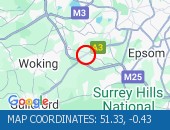
Location: southbound between the junctions with the M25 and the A247 .
Lane Closures : Lanes 2 and 3 will be closed.
Due to: Roadworks are planned.
Status : Pending.
Schedule : Expect disruption everyday between 22:00 and 05:30 from 18 March 2025 to 21 March 2025.
Lanes Closed : There will be two of three lanes closed.
Nearest town: 12.69 miles from Nalderswood.

Location: southbound at the junction with the M25 .
Lane Closures : Lane two will be closed.
Due to: Roadworks are planned.
Status : Pending.
Schedule : Expect disruption everyday between 22:00 and 05:30 from 18 March 2025 to 21 March 2025.
Lanes Closed : There will be one of two lanes closed.
Nearest town: 12.85 miles from Nalderswood.

Location: anticlockwise entry slip at junction J12 (Basingstoke) .
Lane Closures : Lanes 1 and 2 will be closed.
Due to: Roadworks are planned.
Status : Pending.
Schedule : Expect disruption everyday between 22:00 and 05:30 from 18 March 2025 to 21 March 2025.
Lanes Closed : All lanes will be closed.
Nearest town: 19.46 miles from Nalderswood.

Location: clockwise entry slip at junction J12 (Basingstoke) .
Lane Closures : Lanes 1 and 2 will be closed.
Due to: Roadworks are planned.
Status : Pending.
Schedule : Expect disruption everyday between 22:00 and 05:30 from 18 March 2025 to 21 March 2025.
Lanes Closed : All lanes will be closed.
Nearest town: 19.53 miles from Nalderswood.
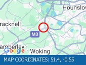
Location: eastbound at junction J2 (Gatwick M23) .
Lane Closures : Lanes 1 and 2 will be closed.
Due to: Roadworks are planned.
Status : Pending.
Schedule : Expect disruption everyday between 22:00 and 05:30 from 18 March 2025 to 21 March 2025.
Lanes Closed : All lanes will be closed.
Nearest town: 19.53 miles from Nalderswood.

Location: eastbound exit slip at junction J2 (Gatwick M23) .
Due to: Roadworks are planned.
Status : Pending.
Schedule : Expect disruption everyday between 22:00 and 05:30 from 18 March 2025 to 21 March 2025.
Lanes Closed : All lanes will be closed.
Nearest town: 19.5 miles from Nalderswood.

Location: southbound between the A244 and the junction with the M25 .
Lane Closures : Lanes 2 and 3 will be closed.
Due to: Roadworks are planned.
Status : Pending.
Schedule : Expect disruption everyday between 22:00 and 05:30 from 18 March 2025 to 21 March 2025.
Lanes Closed : There will be two of three lanes closed.
Nearest town: 12.61 miles from Nalderswood.

Location: northbound at junction J8 (Reigate) .
Lane Closures : Lanes 1 and 2 will be closed.
Due to: Roadworks are planned.
Status : Pending.
Schedule : Expect disruption everyday between 22:00 and 05:30 from 18 March 2025 to 22 March 2025.
Lanes Closed : All lanes will be closed.
Nearest town: 6.84 miles from Nalderswood.

Location: northbound between the junctions with the M23 and the A237 .
Due to: Roadworks are planned.
Status : Pending.
Schedule : Expect disruption everyday between 22:00 and 05:30 from 18 March 2025 to 21 March 2025.
Schedule : From 23:00 on 21 March 2025 to 05:30 on 22 March 2025.
Lanes Closed : All lanes will be closed.
Nearest town: 8.39 miles from Nalderswood.
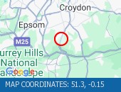
Location: northbound between the junctions with the M23 and the A237 .
Due to: Roadworks are planned.
Status : Pending.
Schedule : Expect disruption everyday between 22:00 and 05:30 from 18 March 2025 to 21 March 2025.
Schedule : From 23:00 on 21 March 2025 to 05:30 on 22 March 2025.
Nearest town: 7.91 miles from Nalderswood.
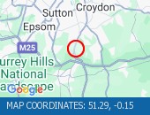
Location: southbound between the junctions with the A237 and the M23 .
Due to: Roadworks are planned.
Status : Pending.
Schedule : Expect disruption everyday between 22:00 and 05:30 from 18 March 2025 to 21 March 2025.
Schedule : From 23:00 on 21 March 2025 to 05:30 on 22 March 2025.
Nearest town: 8.52 miles from Nalderswood.

Location: westbound between junctions J9 (Gatwick Airport) and J9A .
Due to: Roadworks are planned.
Status : Pending.
Schedule : Expect disruption everyday between 21:00 and 06:00 from 31 March 2025 to 3 April 2025.
Lanes Closed : All lanes will be closed.
Nearest town: 5.07 miles from Nalderswood.
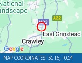
Location: northbound exit slip at junction J9 (Gatwick Airport) .
Due to: Roadworks are planned.
Status : Pending.
Schedule : Expect disruption everyday between 21:00 and 06:00 from 31 March 2025 to 3 April 2025.
Lanes Closed : All lanes will be closed.
Nearest town: 5.12 miles from Nalderswood.

Location: northbound exit slip at junction J9 (Gatwick Airport) .
Lane Closures : Lane one will be closed.
Due to: Roadworks are planned.
Status : Pending.
Schedule : Expect disruption everyday between 21:00 and 06:00 from 31 March 2025 to 3 April 2025.
Lanes Closed : There will be one of two lanes closed.
Nearest town: 5.21 miles from Nalderswood.
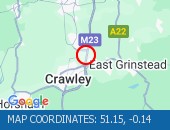
Location: northbound between junctions J10 (Crawley) and J9 (Gatwick Airport) .
Lane Closures : Lane one will be closed.
Due to: Roadworks are planned.
Status : Pending.
Schedule : Expect disruption everyday between 21:00 and 06:00 from 31 March 2025 to 3 April 2025.
Lanes Closed : There will be one of four lanes closed.
Nearest town: 5.62 miles from Nalderswood.
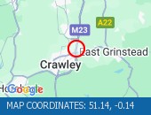
Location: southbound exit slip at junction J9 (Gatwick Airport) .
Lane Closures : Lane one will be closed.
Due to: Roadworks are planned.
Status : Pending.
Schedule : Expect disruption everyday between 21:00 and 06:00 from 31 March 2025 to 3 April 2025.
Lanes Closed : There will be one of two lanes closed.
Nearest town: 5.12 miles from Nalderswood.
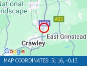
Location: southbound between junctions J8 (Reigate) and J9 (Gatwick Airport) .
Lane Closures : Lane one will be closed.
Due to: Roadworks are planned.
Status : Pending.
Schedule : Expect disruption everyday between 21:00 and 06:00 from 31 March 2025 to 3 April 2025.
Lanes Closed : There will be one of four lanes closed.
Nearest town: 4.97 miles from Nalderswood.
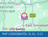
Location: northbound.
Lane Closures : Lane two will be closed.
Due to: Roadworks are planned.
Status : Pending.
Schedule : Expect disruption everyday between 21:00 and 06:00 from 20 March 2025 to 22 March 2025.
Schedule : Expect disruption everyday between 21:00 and 06:00 from 24 March 2025 to 28 March 2025.
Lanes Closed : There will be one of two lanes closed.
Nearest town: 4.33 miles from Nalderswood.

Location: northbound.
Lane Closures : Lane two will be closed.
Due to: Roadworks are planned.
Status : Pending.
Schedule : Expect disruption everyday between 21:00 and 06:00 from 31 March 2025 to 3 April 2025.
Lanes Closed : There will be one of two lanes closed.
Nearest town: 4.32 miles from Nalderswood.

Location: northbound.
Due to: Roadworks are planned.
Status : Pending.
Schedule : From 21:00 on 18 March 2025 to 06:00 on 19 March 2025.
Schedule : Expect disruption everyday between 21:00 and 06:00 from 20 March 2025 to 22 March 2025.
Schedule : Expect disruption everyday between 21:00 and 06:00 from 24 March 2025 to 28 March 2025.
Lanes Closed : All lanes will be closed.
Nearest town: 3.56 miles from Nalderswood.

Location: The A23 southbound.
Lane Closures : Lane two will be closed.
Due to: Roadworks are planned.
Status : Pending.
Schedule : From 21:00 on 27 March 2025 to 06:00 on 28 March 2025.
Lanes Closed : There will be one of two lanes closed.
Nearest town: 4.36 miles from Nalderswood.

Location: The M23 SPUR eastbound between junctions J9A and J9 .
Lane Closures : Lane two will be closed.
Due to: Roadworks are planned.
Status : Pending.
Schedule : From 21:00 on 27 March 2025 to 06:00 on 28 March 2025.
Lanes Closed : There will be one of two lanes closed.
Nearest town: 4.1 miles from Nalderswood.

Location: southbound at junction J10 (Crawley) .
Lane Closures : Lanes 1, 2 and 3 will be closed.
Due to: Roadworks are planned.
Status : Pending.
Schedule : Expect disruption everyday between 20:00 and 06:00 from 19 March 2025 to 21 March 2025.
Schedule : From 20:00 on 28 March 2025 to 06:00 on 29 March 2025.
Schedule : From 20:00 on 29 March 2025 to 06:00 on 30 March 2025.
Schedule : From 20:00 on 30 March 2025 to 06:00 on 31 March 2025.
Lanes Closed : All lanes will be closed.
Nearest town: 5.78 miles from Nalderswood.

Location: northbound between junctions J11 (Brighton) and J10A (Crawley) .
Due to: Roadworks are planned.
Status : Pending.
Schedule : From 20:00 on 18 March 2025 to 06:00 on 19 March 2025.
Schedule : From 20:00 on 28 March 2025 to 06:00 on 29 March 2025.
Schedule : From 20:00 on 29 March 2025 to 06:00 on 30 March 2025.
Schedule : From 20:00 on 30 March 2025 to 06:00 on 31 March 2025.
Lanes Closed : All lanes will be closed.
Nearest town: 7.42 miles from Nalderswood.

Location: northbound at junction J11 (Brighton) .
Due to: Roadworks are planned.
Status : Pending.
Schedule : From 20:00 on 18 March 2025 to 06:00 on 19 March 2025.
Schedule : From 20:00 on 28 March 2025 to 06:00 on 29 March 2025.
Schedule : From 20:00 on 29 March 2025 to 06:00 on 30 March 2025.
Schedule : From 20:00 on 30 March 2025 to 06:00 on 31 March 2025.
Lanes Closed : All lanes will be closed.
Nearest town: 7.57 miles from Nalderswood.

Location: northbound between the junctions with the A272 and the M23 .
Due to: Roadworks are planned.
Status : Pending.
Schedule : From 20:00 on 18 March 2025 to 06:00 on 19 March 2025.
Schedule : From 20:00 on 28 March 2025 to 06:00 on 29 March 2025.
Schedule : From 20:00 on 29 March 2025 to 06:00 on 30 March 2025.
Schedule : From 20:00 on 30 March 2025 to 06:00 on 31 March 2025.
Lanes Closed : All lanes will be closed.
Nearest town: 7.64 miles from Nalderswood.

Location: southbound between junctions J10 (Crawley) and J11 (Brighton) .
Due to: Roadworks scheme is planned.
Status : Pending.
Schedule : From 20:00 on 19 March 2025 to 06:00 on 16 December 2025.
Nearest town: 5.98 miles from Nalderswood.
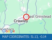
Location: southbound between junctions J10 (Crawley) and J11 (Brighton) .
Due to: Roadworks are planned.
Status : Pending.
Schedule : Expect disruption everyday between 20:00 and 06:00 from 19 March 2025 to 21 March 2025.
Schedule : From 20:00 on 28 March 2025 to 06:00 on 29 March 2025.
Schedule : From 20:00 on 29 March 2025 to 06:00 on 30 March 2025.
Schedule : From 20:00 on 30 March 2025 to 06:00 on 31 March 2025.
Lanes Closed : All lanes will be closed.
Nearest town: 5.98 miles from Nalderswood.

Location: southbound between the junctions with the M23 and the A272 .
Due to: Roadworks are planned.
Status : Pending.
Schedule : Expect disruption everyday between 20:00 and 06:00 from 19 March 2025 to 21 March 2025.
Schedule : From 20:00 on 28 March 2025 to 06:00 on 29 March 2025.
Schedule : From 20:00 on 29 March 2025 to 06:00 on 30 March 2025.
Schedule : From 20:00 on 30 March 2025 to 06:00 on 31 March 2025.
Lanes Closed : All lanes will be closed.
Nearest town: 7.61 miles from Nalderswood.

Location: southbound between the junctions with the M23 and the A272 .
Lane Closures : Lane three will be closed.
Due to: Roadworks are planned.
Status : Pending.
Schedule : From 20:00 on 18 March 2025 to 06:00 on 19 March 2025.
Schedule : From 20:00 on 28 March 2025 to 06:00 on 29 March 2025.
Schedule : From 20:00 on 29 March 2025 to 06:00 on 30 March 2025.
Schedule : From 20:00 on 30 March 2025 to 06:00 on 31 March 2025.
Lanes Closed : There will be one of three lanes closed.
Nearest town: 7.94 miles from Nalderswood.

Location: southbound.
Due to: Roadworks are planned.
Status : Pending.
Schedule : Expect disruption everyday between 20:00 and 06:00 from 10 April 2025 to 12 April 2025.
Schedule : Expect disruption everyday between 20:00 and 06:00 from 14 April 2025 to 17 April 2025.
Schedule : Expect disruption everyday between 20:00 and 06:00 from 22 April 2025 to 26 April 2025.
Schedule : Expect disruption everyday between 20:00 and 06:00 from 28 April 2025 to 3 May 2025.
Nearest town: 15.24 miles from Nalderswood.
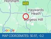
Location: southbound.
Due to: Roadworks are planned.
Status : Pending.
Schedule : Expect disruption everyday between 20:00 and 06:00 from 10 April 2025 to 12 April 2025.
Schedule : Expect disruption everyday between 20:00 and 06:00 from 14 April 2025 to 17 April 2025.
Schedule : Expect disruption everyday between 20:00 and 06:00 from 22 April 2025 to 26 April 2025.
Schedule : Expect disruption everyday between 20:00 and 06:00 from 28 April 2025 to 3 May 2025.
Nearest town: 15.55 miles from Nalderswood.

Location: northbound exit slip to the A2300 .
Due to: Roadworks are planned.
Status : Pending.
Schedule : Expect disruption everyday between 20:00 and 06:00 from 18 March 2025 to 22 March 2025.
Schedule : Expect disruption everyday between 20:00 and 06:00 from 24 March 2025 to 29 March 2025.
Schedule : Expect disruption everyday between 20:00 and 06:00 from 31 March 2025 to 5 April 2025.
Schedule : Expect disruption everyday between 20:00 and 06:00 from 7 April 2025 to 12 April 2025.
Lanes Closed : All lanes will be closed.
Nearest town: 15.85 miles from Nalderswood.
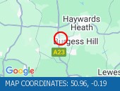
Location: northbound exit slip to the A2300 .
Due to: Roadworks are planned.
Status : Pending.
Schedule : Expect disruption everyday between 20:00 and 06:00 from 10 April 2025 to 12 April 2025.
Schedule : Expect disruption everyday between 20:00 and 06:00 from 14 April 2025 to 17 April 2025.
Schedule : Expect disruption everyday between 20:00 and 06:00 from 22 April 2025 to 26 April 2025.
Schedule : Expect disruption everyday between 20:00 and 06:00 from 28 April 2025 to 3 May 2025.
Nearest town: 15.63 miles from Nalderswood.

Location: northbound entry slip from the A2300 .
Due to: Roadworks are planned.
Status : Pending.
Schedule : Expect disruption everyday between 20:00 and 06:00 from 22 April 2025 to 26 April 2025.
Lanes Closed : All lanes will be closed.
Nearest town: 14.8 miles from Nalderswood.
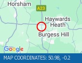
Location: northbound between the A281 and the junction with the A2300 .
Lane Closures : Lane one is closed.
Due to: Roadworks.
Period : expect disruption until 06:00 on 19 March 2025.
Lanes Closed : There is one of two lanes closed.
Nearest town: 16.45 miles from Nalderswood.
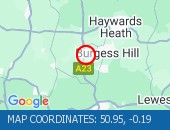
Location: northbound entry slip from the A2300 .
Due to: Roadworks are planned.
Status : Pending.
Schedule : Expect disruption everyday between 20:00 and 06:00 from 10 April 2025 to 12 April 2025.
Schedule : Expect disruption everyday between 20:00 and 06:00 from 14 April 2025 to 17 April 2025.
Schedule : Expect disruption everyday between 20:00 and 06:00 from 22 April 2025 to 26 April 2025.
Schedule : Expect disruption everyday between 20:00 and 06:00 from 28 April 2025 to 3 May 2025.
Nearest town: 15.53 miles from Nalderswood.

Location: southbound between the A31 and the junction with the A272 .
Due to: Roadworks scheme is planned.
Status : Pending.
Schedule : From 21:00 on 19 March 2025 to 06:00 on 12 April 2025.
Nearest town: 16.53 miles from Nalderswood.

Location: northbound exit slip to the A272 .
Due to: Roadworks scheme is planned.
Status : Pending.
Schedule : From 21:00 on 2 April 2025 to 06:00 on 26 April 2025.
Nearest town: 17.89 miles from Nalderswood.

Location: northbound between junctions J10 (Crawley) and J9 (Gatwick Airport) .
Due to: Roadworks scheme is planned.
Status : Pending.
Schedule : From 21:00 on 31 March 2025 to 06:00 on 3 April 2025.
Nearest town: 5.62 miles from Nalderswood.

Location: southbound between junctions J8 (Reigate) and J9 (Gatwick Airport) .
Due to: Roadworks scheme is planned.
Status : Pending.
Schedule : From 21:00 on 31 March 2025 to 06:00 on 3 April 2025.
Nearest town: 4.97 miles from Nalderswood.

Location: southbound.
Due to: Roadworks scheme is planned.
Status : Pending.
Schedule : From 20:00 on 10 April 2025 to 06:00 on 16 May 2025.
Nearest town: 15.24 miles from Nalderswood.

Location: eastbound between junctions J9A and J9 .
Due to: Roadworks scheme is planned.
Status : Pending.
Schedule : From 21:00 on 27 March 2025 to 06:00 on 28 March 2025.
Nearest town: 4.36 miles from Nalderswood.




 National Highways England
 Transport for London (TFL)
 Traffic Wales
 Traffic Scotland
 YOUR AD HERE


