
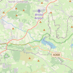


Current traffic around Flat Holm
The following traffic incidents and congestion for Flat Holm have been reported by Highways England, Traffic Scotland, Traffic Wales or Transport for London (TfL) in the last two hours:
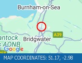
NORTHBOUND Description: A4232Now clearNorthboundA48 Interchange to M4 J33 Capel Llanilltern, Start time: 20/03/2025 17:36 , Expected end time: 20/03/2025 17:41, Severity: Moderate, Source: Welsh Government, Last updated: 20/03/2025 17:36
Nearest town: 10.88 miles from Flat Holm. CLEARED @ 18:54EASTBOUND Description: M4Now clearEastboundJ28 (Newport) Tredegar Park to J26 (Newport) Malpas, Start time: 20/03/2025 17:25 , Expected end time: 20/03/2025 17:30, Severity: Moderate, Source: Welsh Government, Last updated: 20/03/2025 17:25
Nearest town: 15.1 miles from Flat Holm. CLEARED @ 18:42NORTHBOUNDDescription: A4232Now clearNorthboundA48 Interchange to M4 J33 Capel Llanilltern, Start time: 20/03/2025 17:36 , Expected end time: 20/03/2025 17:41, Severity: Moderate, Source: Welsh Government, Last updated: 20/03/2025 17:36
Nearest town: 10.88 miles from Flat Holm. CLEARED @ 17:42NANTGARW TO CORYTON Description: A470SouthboundNantgarw to CorytonCongestionDelay: s possible :, Start time: 20/03/2025 17:21 , Expected end time: 20/03/2025 19:21, Severity: Moderate, Source: Welsh Government, Last updated: 20/03/2025 17:21
Nearest town: 13.27 miles from Flat Holm. CLEARED @ 17:30J29 CASTLETON TO J29A ST MELLONS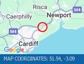 Description: A48MWestboundJ29 Castleton to J29A St MellonsCongestionDelay: s possible :, Start time: 20/03/2025 17:23 , Expected end time: 20/03/2025 19:23, Severity: Moderate, Source: Welsh Government, Last updated: 20/03/2025 17:23
Nearest town: 11.75 miles from Flat Holm. CLEARED @ 17:30CORYTON TO NANTGARWDescription: A470NorthboundCoryton to NantgarwCongestionDelay: s possible :, Start time: 20/03/2025 16:08 , Expected end time: 20/03/2025 19:08, Severity: Moderate, Source: Welsh Government, Last updated: 20/03/2025 16:08
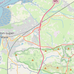
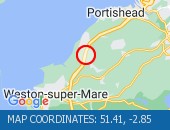
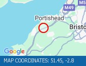
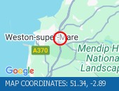
Nearest town: 13.27 miles from Flat Holm. CLEARED @ 16:18VEHICLE RECOVERY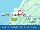 Location: The M5 southbound at junction J21 (Weston super Mare) .
Lane closures: The hard shoulder and lane 1 are closed.
Reason: Vehicle tyre change.
Status: Currently Active.
Time to clear: The event is expected to clear between 16:15 and 16:30 on 20 Mar 2025.
Return to normal: Normal traffic conditions are expected between 16:15 and 16:30 on 20 Mar 2025.
Lanes closed: There is one of three lanes closed.
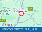
Nearest town: 9.77 miles from Flat Holm. CLEARED @ 16:03J28 TREDEGAR PARK TO J26 MALPASDescription: M4EastboundJ28 (Newport) Tredegar Park to J26 (Newport) MalpasCongestion :, Start time: 20/03/2025 15:15 , Expected end time: 20/03/2025 17:15, Severity: Moderate, Source: Welsh Government, Last updated: 20/03/2025 15:15
Nearest town: 15.1 miles from Flat Holm. CLEARED @ 15:30NANTGARW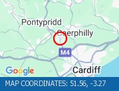 Description: A470NorthboundNantgarwCongestionoffslipDelay: s possible :, Start time: 20/03/2025 15:13 , Expected end time: 20/03/2025 17:13, Severity: Moderate, Source: Welsh Government, Last updated: 20/03/2025 15:13
Nearest town: 14.6 miles from Flat Holm. CLEARED @ 15:18J23A MAGOR TO J26 MALPAS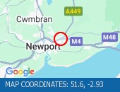 Description: M4WestboundJ23A (Magor) Magor to J26 (Newport) MalpasCongestion :, Start time: 20/03/2025 15:04 , Expected end time: 20/03/2025 19:04, Severity: Moderate, Source: Welsh Government, Last updated: 20/03/2025 15:04
Nearest town: 17.79 miles from Flat Holm. CLEARED @ 15:06A48 INTERCHANGE TO M4 J33 CAPEL LLANILLTERNDescription: A4232NorthboundA48 Interchange to M4 J33 Capel LlanillternCongestionDelay: s possible :, Start time: 20/03/2025 14:41 , Expected end time: 20/03/2025 16:41, Severity: Moderate, Source: Welsh Government, Last updated: 20/03/2025 14:41
Nearest town: 10.88 miles from Flat Holm. CLEARED @ 14:54TUA'R GORLLEWINDisgrifiad: M4Wedi clirioTuar GorllewinC23A Magwyr i G26 Malpas, Amser y digwyddiad: 20/03/2025 19:19 , Amser gorffen a ragwelir: 20/03/2025 19:24, Difrifoldeb: Cymedrol, Ffynhonnell: Llywodraeth Cymru, Diweddarwyd ddiwethaf: 20/03/2025 19:19
Nearest town: 17.79 miles from Flat Holm. CLEARED @ 19:30TUA'R GOGLEDDDisgrifiad: A470Wedi clirioTuar GogleddCoryton i Nantgarw, Amser y digwyddiad: 20/03/2025 17:54 , Amser gorffen a ragwelir: 20/03/2025 17:59, Difrifoldeb: Cymedrol, Ffynhonnell: Llywodraeth Cymru, Diweddarwyd ddiwethaf: 20/03/2025 17:54
Nearest town: 13.27 miles from Flat Holm. CLEARED @ 19:06TUA'R DEDisgrifiad: A470Wedi clirioTuar DeNantgarw i Coryton, Amser y digwyddiad: 20/03/2025 17:54 , Amser gorffen a ragwelir: 20/03/2025 17:59, Difrifoldeb: Cymedrol, Ffynhonnell: Llywodraeth Cymru, Diweddarwyd ddiwethaf: 20/03/2025 17:54
Nearest town: 13.27 miles from Flat Holm. CLEARED @ 19:06TUA'R DWYRAIN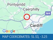 Disgrifiad: M4Wedi clirioTuar DwyrainC32 Coryton, Amser y digwyddiad: 20/03/2025 17:53 , Amser gorffen a ragwelir: 20/03/2025 17:58, Difrifoldeb: Cymedrol, Ffynhonnell: Llywodraeth Cymru, Diweddarwyd ddiwethaf: 20/03/2025 17:53
Nearest town: 11.9 miles from Flat Holm. CLEARED @ 19:06TUA'R DWYRAINDisgrifiad: M4Wedi clirioTuar DwyrainC28 Parc Tredegar i G26 Malpas, Amser y digwyddiad: 20/03/2025 17:25 , Amser gorffen a ragwelir: 20/03/2025 17:30, Difrifoldeb: Cymedrol, Ffynhonnell: Llywodraeth Cymru, Diweddarwyd ddiwethaf: 20/03/2025 17:25
Nearest town: 15.1 miles from Flat Holm. CLEARED @ 17:30C32 CORYTONDisgrifiad: M4Tuar DwyrainC32 CorytonAllanfaTagfeyddOedin Bosibl :, Amser y digwyddiad: 20/03/2025 17:25 , Amser gorffen a ragwelir: 20/03/2025 18:55, Difrifoldeb: Cymedrol, Ffynhonnell: Llywodraeth Cymru, Diweddarwyd ddiwethaf: 20/03/2025 17:25
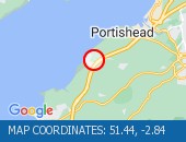
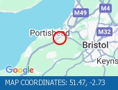
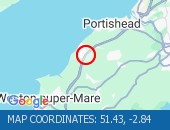
Nearest town: 11.9 miles from Flat Holm. CLEARED @ 17:30CONGESTION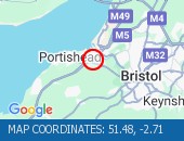 Location: The M5 southbound exit slip at junction J19 (Portishead) .
Reason: Congestion.
Status: Currently Active.
Return to normal: Normal traffic conditions are expected between 16:30 and 16:45 on 20 Mar 2025.
Nearest town: 19.03 miles from Flat Holm. CLEARED @ 16:39M4 J33 CAPEL LLANILLTERN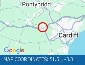 Description: A4232WestboundM4 J33 Capel LlanillternRoadworksEntry slip road closedand Exit slip road closedDiversions in place17/03/25-08/04/25 2000-0600 :, Start time: 17/03/2025 20:00 , End Date: 08/04/2025 6:00, Severity: Road closure, Source: Welsh Government, Last updated: 17/03/2025 20:00
Nearest town: 12.32 miles from Flat Holm. CLEARED @ 15:18
Nearest town: 10.88 miles from Flat Holm. CLEARED @ 18:54
Nearest town: 15.1 miles from Flat Holm. CLEARED @ 18:42
Nearest town: 10.88 miles from Flat Holm. CLEARED @ 17:42
Nearest town: 13.27 miles from Flat Holm. CLEARED @ 17:30
Nearest town: 11.75 miles from Flat Holm. CLEARED @ 17:30
Nearest town: 13.27 miles from Flat Holm. CLEARED @ 16:18
Lane closures: The hard shoulder and lane 1 are closed.
Reason: Vehicle tyre change.
Status: Currently Active.
Time to clear: The event is expected to clear between 16:15 and 16:30 on 20 Mar 2025.
Return to normal: Normal traffic conditions are expected between 16:15 and 16:30 on 20 Mar 2025.
Lanes closed: There is one of three lanes closed.
Nearest town: 9.77 miles from Flat Holm. CLEARED @ 16:03
Nearest town: 15.1 miles from Flat Holm. CLEARED @ 15:30
Nearest town: 14.6 miles from Flat Holm. CLEARED @ 15:18
Nearest town: 17.79 miles from Flat Holm. CLEARED @ 15:06
Nearest town: 10.88 miles from Flat Holm. CLEARED @ 14:54
Nearest town: 17.79 miles from Flat Holm. CLEARED @ 19:30
Nearest town: 13.27 miles from Flat Holm. CLEARED @ 19:06
Nearest town: 13.27 miles from Flat Holm. CLEARED @ 19:06
Nearest town: 11.9 miles from Flat Holm. CLEARED @ 19:06
Nearest town: 15.1 miles from Flat Holm. CLEARED @ 17:30
Nearest town: 11.9 miles from Flat Holm. CLEARED @ 17:30
Reason: Congestion.
Status: Currently Active.
Return to normal: Normal traffic conditions are expected between 16:30 and 16:45 on 20 Mar 2025.
Nearest town: 19.03 miles from Flat Holm. CLEARED @ 16:39
Nearest town: 12.32 miles from Flat Holm. CLEARED @ 15:18
There are no current incidents in this location.


 National Highways England
 Transport for London (TFL)
 Traffic Wales
 Traffic Scotland
 YOUR AD HERE