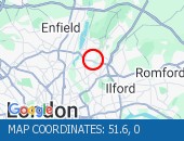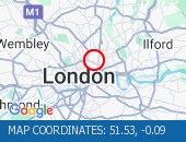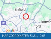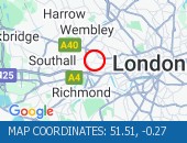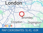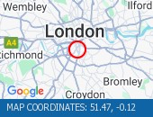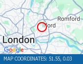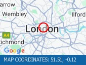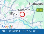
Current traffic around St Pancras
The following traffic incidents and congestion for St Pancras have been reported by Highways England, Traffic Scotland, Traffic Wales or Transport for London (TfL) in the last two hours:
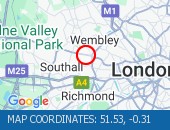
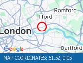
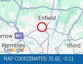
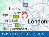
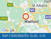
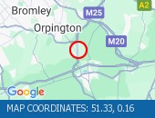
VEHICLE FIRE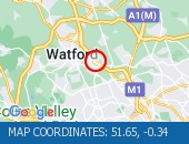 Location: The M1 northbound between junctions J1 (North Circular) and J5 (Harrow A41) .
Lane closures: The hard shoulder, lanes 1 and 2 are closed.
Reason: Vehicle fire.
Status: Currently Active.
Time to clear: The event is expected to clear between 23:30 and 23:45 on 9 May 2024.
Return to normal: Normal traffic conditions are expected between 23:30 and 23:45 on 9 May 2024.
Lanes closed: There are two of three lanes closed.
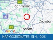
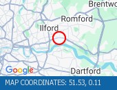
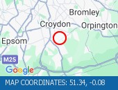
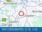
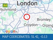
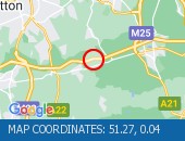
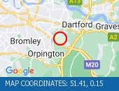
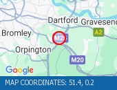
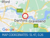
Nearest town: 12.76 miles from St Pancras. CLEARED @ 23:06BROKEN DOWN VEHICLE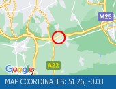 Location: The M25 anticlockwise between junctions J6 (East Grinstead) and J5 (Sevenoaks) .
Lane closures: Lane one is closed.
Reason: Broken down vehicle.
Status: Currently Active.
Time to clear: The event is expected to clear between 22:30 and 22:45 on 9 May 2024.
Return to normal: Normal traffic conditions are expected between 22:30 and 22:45 on 9 May 2024.
Lanes closed: There is one of four lanes closed.
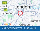
Nearest town: 18.33 miles from St Pancras. CLEARED @ 21:45BROKEN DOWN VEHICLE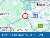 Location: The M3 westbound entry slip at junction J2 (Gatwick M23) from M25 clockwise.
Lane closures: The hard shoulder and lane 1 are closed.
Reason: Broken down vehicle.
Status: Currently Active.
Time to clear: The event is expected to clear between 20:00 and 20:15 on 9 May 2024.
Return to normal: Normal traffic conditions are expected between 20:00 and 20:15 on 9 May 2024.
Lanes closed: There is one of two lanes closed.
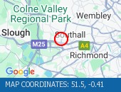
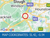
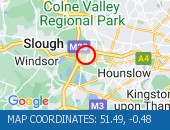
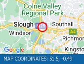
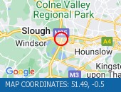
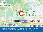
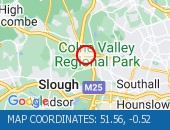
Nearest town: 19.69 miles from St Pancras. CLEARED @ 19:30BROKEN DOWN VEHICLE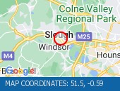 Location: The M4 eastbound between junctions J6 (Slough) and J5 (Colnbrook) .
Lane closures: The hard shoulder and lane 1 are closed.
Reason: Broken down vehicle.
Status: Currently Active.
Time to clear: The event is expected to clear between 19:30 and 19:45 on 9 May 2024.
Return to normal: Normal traffic conditions are expected between 19:30 and 19:45 on 9 May 2024.
Lanes closed: There is one of four lanes closed.
Nearest town: 19.9 miles from St Pancras. CLEARED @ 19:03BROKEN DOWN VEHICLE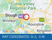 Location: The M4 eastbound exit slip at junction J4 .
Lane closures: The hard shoulder and lane 1 are closed.
Reason: Broken down vehicle.
Status: Currently Active.
Time to clear: The event is expected to clear between 19:00 and 19:15 on 9 May 2024.
Return to normal: Normal traffic conditions are expected between 19:00 and 19:15 on 9 May 2024.
Lanes closed: There is one of three lanes closed.
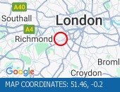
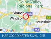
Nearest town: 14.25 miles from St Pancras. CLEARED @ 18:36ACCIDENT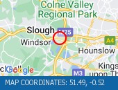 Location: The M4 eastbound between junctions J5 (Colnbrook) and J4B (Heathrow) .
Lane closures: The hard shoulder and lane 1 are closed.
Reason: Road traffic collision.
Status: Currently Active.
Time to clear: The event is expected to clear between 19:45 and 20:00 on 9 May 2024.
Return to normal: Normal traffic conditions are expected between 19:45 and 20:00 on 9 May 2024.
Lanes closed: There is one of five lanes closed.
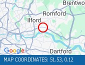
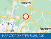
Nearest town: 16.97 miles from St Pancras. CLEARED @ 19:03BROKEN DOWN VEHICLE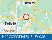 Location: The M25 clockwise between junctions J26 (Waltham Abbey) and J27 (Stansted) .
Lane closures: Lane one is closed.
Reason: Broken down vehicle.
Status: Currently Active.
Time to clear: The event is expected to clear between 19:00 and 19:15 on 9 May 2024.
Return to normal: Normal traffic conditions are expected between 19:00 and 19:15 on 9 May 2024.
Delay: There are currently delays of 10 minutes against expected traffic.
Lanes closed: There is one of four lanes closed.
Nearest town: 14.01 miles from St Pancras. CLEARED @ 18:45BROKEN DOWN VEHICLE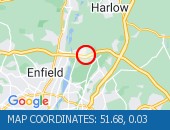 Location: The M25 clockwise entry slip at junction J26 (Waltham Abbey) .
Reason: Broken down vehicle.
Status: Currently Active.
Time to clear: The event is expected to clear between 18:45 and 19:00 on 9 May 2024.
Return to normal: Normal traffic conditions are expected between 18:45 and 19:00 on 9 May 2024.
Lanes closed: There are lane closures.
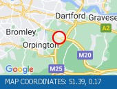
Nearest town: 12.76 miles from St Pancras. CLEARED @ 18:09ACCIDENT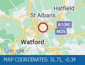 Location: The M25 clockwise between junctions J21A (Watword) and J22 (St Albans) .
Reason: Road traffic collision.
Status: Cleared.
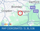
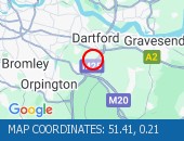
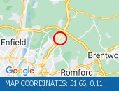
Nearest town: 15.84 miles from St Pancras. CLEARED @ 19:30BROKEN DOWN VEHICLE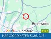 Location: The M25 clockwise between junctions J27 (Stansted) and J28 (Chelmsford) .
Lane closures: The hard shoulder and lane 1 are closed.
Reason: Broken down vehicle with a brake issue.
Status: Currently Active.
Time to clear: The event is expected to clear between 20:00 and 20:15 on 9 May 2024.
Return to normal: Normal traffic conditions are expected between 20:00 and 20:15 on 9 May 2024.
Lanes closed: There is one of four lanes closed.
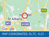
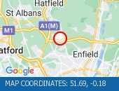
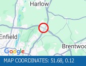
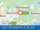
Nearest town: 15.93 miles from St Pancras. CLEARED @ 19:12CONGESTION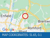 Location: The M11 northbound between junctions J5 (Loughton) and J6 (Hatfield) .
Reason: Congestion.
Status: Currently Active.
Return to normal: Normal traffic conditions are expected between 23:45 and 00:00 on 10 May 2024.
Delay: There are currently delays of 15 minutes against expected traffic.
Nearest town: 13.5 miles from St Pancras.CONGESTION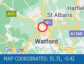 Location: The M25 anticlockwise between junctions J21 (M1) and J20 (Hemel Hstead) .
Reason: Congestion.
Status: Currently Active.
Return to normal: Normal traffic conditions are expected between 23:45 and 00:00 on 10 May 2024.
Delay: There are currently delays of 10 minutes against expected traffic.
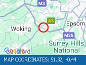
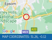
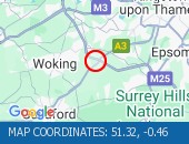
Nearest town: 18.21 miles from St Pancras.CONGESTION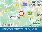 Location: The M25 anticlockwise between junctions J11 (Chertsey) and J10 (Guildford) .
Reason: Congestion.
Status: Currently Active.
Return to normal: Normal traffic conditions are expected between 23:45 and 00:00 on 10 May 2024.
Delay: There are currently delays of 15 minutes against expected traffic.
Nearest town: 19.71 miles from St Pancras.CONGESTION Location: The A30 eastbound between the junctions with the M25 and the A308 .
Reason: Congestion.
Status: Currently Active.
Return to normal: Normal traffic conditions are expected between 20:45 and 21:00 on 9 May 2024.
Nearest town: 17.08 miles from St Pancras. CLEARED @ 20:51CONGESTION Location: The M4 westbound at junction J2 (N.Circular) .
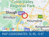
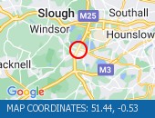
Reason: Congestion.
Status: Currently Active.
Return to normal: Normal traffic conditions are expected between 20:15 and 20:30 on 9 May 2024.
Delay: There are currently delays of 10 minutes against expected traffic.
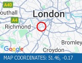
Nearest town: 7.54 miles from St Pancras. CLEARED @ 20:15CONGESTION Location: The M25 clockwise exit slip at junction J10 (Guildford) .
Reason: Congestion.
Status: Currently Active.
Return to normal: Normal traffic conditions are expected between 20:00 and 20:15 on 9 May 2024.
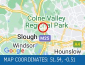
Nearest town: 19.56 miles from St Pancras. CLEARED @ 20:06CONGESTION Location: The M4 westbound between junctions J1 (London) and J2 (N.Circular) .
Reason: Congestion.
Status: Currently Active.
Return to normal: Normal traffic conditions are expected between 19:30 and 19:45 on 9 May 2024.
Delay: There are currently delays of 10 minutes against expected traffic.
Nearest town: 6.83 miles from St Pancras. CLEARED @ 19:39CONGESTION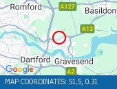 Location: The A13 eastbound exit slip to the A1012 .
Reason: Congestion.
Status: Currently Active.
Return to normal: Normal traffic conditions are expected between 19:45 and 20:00 on 9 May 2024.
Delay: There are currently delays of 10 minutes against expected traffic.
Nearest town: 18.99 miles from St Pancras. CLEARED @ 19:57CONGESTION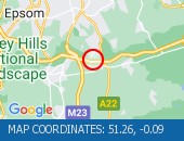 Location: The M25 anticlockwise between junctions J7 (Gatwick) and J6 (East Grinstead) .
Reason: Congestion.
Status: Currently Active.
Return to normal: Normal traffic conditions are expected between 19:30 and 19:45 on 9 May 2024.
Delay: There are currently delays of 10 minutes against expected traffic.
Nearest town: 18.31 miles from St Pancras. CLEARED @ 19:30CONGESTIONLocation: The M3 westbound entry slip at junction J2 (Gatwick M23) from M25 anti-clockwise.
Reason: Congestion.
Status: Currently Active.
Return to normal: Normal traffic conditions are expected between 19:00 and 19:15 on 9 May 2024.
Delay: There are currently delays of 10 minutes against expected traffic.
Nearest town: 19.55 miles from St Pancras. CLEARED @ 19:12CONGESTIONLocation: The M25 clockwise exit slip at junction J10 (Guildford) .
Reason: Congestion.
Status: Currently Active.
Return to normal: Normal traffic conditions are expected between 19:15 and 19:30 on 9 May 2024.
Delay: There are currently delays of 10 minutes against expected traffic.
Nearest town: 19.56 miles from St Pancras. CLEARED @ 19:21CONGESTION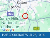 Location: The A23 northbound between the junctions with the M23 and the A237 .
Reason: Congestion.
Status: Currently Active.
Return to normal: Normal traffic conditions are expected between 19:15 and 19:30 on 9 May 2024.
Nearest town: 16.52 miles from St Pancras. CLEARED @ 19:12CONGESTION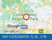 Location: The A40 westbound between the junctions with the A437 and the M40 .
Reason: Congestion.
Status: Currently Active.
Return to normal: Normal traffic conditions are expected between 19:00 and 19:15 on 9 May 2024.
Delay: There are currently delays of 10 minutes against expected traffic.
Nearest town: 15.38 miles from St Pancras. CLEARED @ 19:12CONGESTIONLocation: The A30 eastbound between the junctions with the M25 and the A308 .
Reason: Congestion.
Status: Currently Active.
Return to normal: Normal traffic conditions are expected between 19:00 and 19:15 on 9 May 2024.
Nearest town: 17.08 miles from St Pancras. CLEARED @ 19:03CONGESTION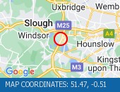 Location: The M25 clockwise at junction J14 (Heathrow Airport) .
Reason: Congestion.
Status: Currently Active.
Return to normal: Normal traffic conditions are expected between 18:45 and 19:00 on 9 May 2024.
Delay: There are currently delays of 10 minutes against expected traffic.
Nearest town: 16.75 miles from St Pancras. CLEARED @ 18:54CONGESTION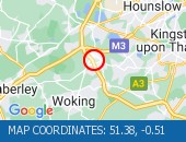 Location: The M25 clockwise at junction J11 (Chertsey) .
Reason: Congestion.
Status: Currently Active.
Return to normal: Normal traffic conditions are expected between 18:45 and 19:00 on 9 May 2024.
Delay: There are currently delays of 10 minutes against expected traffic.
Nearest town: 19.31 miles from St Pancras. CLEARED @ 18:54CONGESTION Location: The M25 clockwise exit slip at junction J2 (London (SE)) .
Reason: Congestion.
Status: Currently Active.
Return to normal: Normal traffic conditions are expected between 18:45 and 19:00 on 9 May 2024.
Delay: There are currently delays of 10 minutes against expected traffic.
Nearest town: 17.03 miles from St Pancras. CLEARED @ 18:54CONGESTIONLocation: The M3 westbound entry slip at junction J2 (Gatwick M23) from M25 clockwise.
Reason: Congestion.
Status: Currently Active.
Return to normal: Normal traffic conditions are expected between 18:45 and 19:00 on 9 May 2024.
Delay: There are currently delays of 10 minutes against expected traffic.
Nearest town: 19.7 miles from St Pancras. CLEARED @ 18:45CONGESTIONLocation: The M3 westbound entry slip at junction J2 (Gatwick M23) from M25 anti-clockwise.
Reason: Congestion.
Status: Currently Active.
Return to normal: Normal traffic conditions are expected between 18:45 and 19:00 on 9 May 2024.
Delay: There are currently delays of 10 minutes against expected traffic.
Nearest town: 19.55 miles from St Pancras. CLEARED @ 18:45CONGESTION Location: The M25 clockwise exit slip at junction J9 (Leatherhead) .
Reason: Congestion.
Status: Currently Active.
Return to normal: Normal traffic conditions are expected between 18:45 and 19:00 on 9 May 2024.
Nearest town: 17.28 miles from St Pancras. CLEARED @ 18:54CONGESTIONLocation: The M25 clockwise exit slip at junction J12 (Basingstoke) .
Reason: Congestion.
Status: Currently Active.
Return to normal: Normal traffic conditions are expected between 18:45 and 19:00 on 9 May 2024.
Delay: There are currently delays of 10 minutes against expected traffic.
Nearest town: 19.58 miles from St Pancras. CLEARED @ 18:45CONGESTION Location: The A2 westbound exit slip to the A2018 .
Reason: Congestion.
Status: Currently Active.
Return to normal: Normal traffic conditions are expected between 18:45 and 19:00 on 9 May 2024.
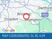
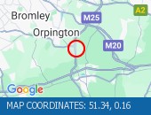
Nearest town: 14.56 miles from St Pancras. CLEARED @ 18:45CONGESTION Location: The M25 clockwise exit slip at junction J21A (Watword) .
Reason: Congestion.
Status: Currently Active.
Return to normal: Normal traffic conditions are expected between 18:30 and 18:45 on 9 May 2024.
Delay: There are currently delays of 10 minutes against expected traffic.
Nearest town: 17.12 miles from St Pancras. CLEARED @ 18:36CONGESTIONLocation: The M25 clockwise exit slip at junction J10 (Guildford) .
Reason: Congestion.
Status: Currently Active.
Return to normal: Normal traffic conditions are expected between 18:45 and 19:00 on 9 May 2024.
Delay: There are currently delays of 10 minutes against expected traffic.
Nearest town: 19.56 miles from St Pancras. CLEARED @ 18:54CONGESTION Location: The M25 anticlockwise exit slip at junction J8 (Reigate) .
Reason: Congestion.
Status: Currently Active.
Return to normal: Normal traffic conditions are expected between 19:15 and 19:30 on 9 May 2024.
Nearest town: 18.47 miles from St Pancras. CLEARED @ 19:21CONGESTION Location: The M25 anticlockwise entry slip at junction J1A (Erith) .
Reason: Congestion.
Status: Currently Active.
Return to normal: Normal traffic conditions are expected between 18:30 and 18:45 on 9 May 2024.
Delay: There are currently delays of 10 minutes against expected traffic.
Nearest town: 16.58 miles from St Pancras. CLEARED @ 18:36CONGESTION Location: The M25 anticlockwise exit slip at junction J20 (Hemel Hstead) .
Reason: Congestion.
Status: Currently Active.
Return to normal: Normal traffic conditions are expected between 18:30 and 18:45 on 9 May 2024.
Delay: There are currently delays of 10 minutes against expected traffic.
Nearest town: 18.33 miles from St Pancras. CLEARED @ 18:27CONGESTION Location: The A1 northbound exit slip to the M25 .
Reason: Congestion.
Status: Currently Active.
Return to normal: Normal traffic conditions are expected between 18:30 and 18:45 on 9 May 2024.
Delay: There are currently delays of 10 minutes against expected traffic.
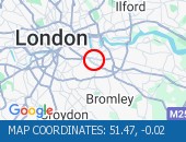
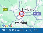
Nearest town: 12.03 miles from St Pancras. CLEARED @ 18:27CONGESTION Location: The A414 eastbound between the junctions with the M1 and the A405 .
Reason: Congestion.
Status: Currently Active.
Return to normal: Normal traffic conditions are expected between 18:45 and 19:00 on 9 May 2024.
Delay: There are currently delays of 10 minutes against expected traffic.
Nearest town: 18.44 miles from St Pancras. CLEARED @ 18:45CONGESTION Location: The M25 clockwise exit slip at junction J22 (St Albans) .
Reason: Congestion.
Status: Currently Active.
Return to normal: Normal traffic conditions are expected between 19:15 and 19:30 on 9 May 2024.
Nearest town: 14.93 miles from St Pancras. CLEARED @ 19:12CONGESTIONLocation: The M25 clockwise exit slip at junction J21A (Watword) .
Reason: Congestion.
Status: Currently Active.
Return to normal: Normal traffic conditions are expected between 18:00 and 18:15 on 9 May 2024.
Delay: There are currently delays of 10 minutes against expected traffic.
Nearest town: 17.12 miles from St Pancras. CLEARED @ 18:09CONGESTION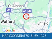 Location: The A1M southbound exit slip at junction J1 .
Reason: Congestion.
Status: Currently Active.
Return to normal: Normal traffic conditions are expected between 18:30 and 18:45 on 9 May 2024.
Delay: There are currently delays of 10 minutes against expected traffic.
Nearest town: 12.3 miles from St Pancras. CLEARED @ 18:27CONGESTION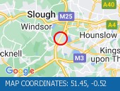 Location: The M25 clockwise between junctions J13 (A30) and J14 (Heathrow Airport) .
Reason: Congestion.
Status: Currently Active.
Return to normal: Normal traffic conditions are expected between 18:45 and 19:00 on 9 May 2024.
Delay: There are currently delays of 10 minutes against expected traffic.
Nearest town: 17.51 miles from St Pancras. CLEARED @ 18:27CONGESTIONLocation: The A2 eastbound entry slip from the M25 .
Reason: Congestion.
Status: Currently Active.
Return to normal: Normal traffic conditions are expected between 18:45 and 19:00 on 9 May 2024.
Delay: There are currently delays of 10 minutes against expected traffic.
Nearest town: 17.19 miles from St Pancras. CLEARED @ 18:45CONGESTION Location: The A2 eastbound exit slip to the M25 .
Reason: Congestion.
Status: Currently Active.
Return to normal: Normal traffic conditions are expected between 18:45 and 19:00 on 9 May 2024.
Delay: There are currently delays of 10 minutes against expected traffic.
Nearest town: 14.19 miles from St Pancras. CLEARED @ 18:45CONGESTIONLocation: The M25 clockwise exit slip at junction J2 (London (SE)) .
Reason: Congestion.
Status: Currently Active.
Return to normal: Normal traffic conditions are expected between 18:30 and 18:45 on 9 May 2024.
Nearest town: 17.03 miles from St Pancras. CLEARED @ 18:36CONGESTION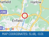 Location: The M25 anticlockwise between junctions J26 (Waltham Abbey) and J25 (Enfield) .
Reason: Congestion.
Status: Currently Active.
Return to normal: Normal traffic conditions are expected between 18:30 and 18:45 on 9 May 2024.
Delay: There are currently delays of 10 minutes against expected traffic.
Nearest town: 12.12 miles from St Pancras. CLEARED @ 18:18CONGESTIONLocation: The M25 clockwise exit slip at junction J26 (Waltham Abbey) .
Reason: Congestion.
Status: Currently Active.
Return to normal: Normal traffic conditions are expected between 18:00 and 18:15 on 9 May 2024.
Nearest town: 12.69 miles from St Pancras. CLEARED @ 18:00CONGESTION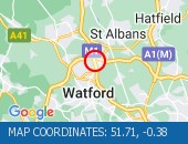 Location: The A405 northbound at the junction with the M1 .
Reason: Congestion.
Status: Currently Active.
Return to normal: Normal traffic conditions are expected between 18:00 and 18:15 on 9 May 2024.
Nearest town: 16.73 miles from St Pancras. CLEARED @ 18:00CONGESTION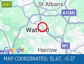 Location: The M1 northbound exit slip at junction J5 (Harrow A41) .
Reason: Congestion.
Status: Currently Active.
Return to normal: Normal traffic conditions are expected between 18:45 and 19:00 on 9 May 2024.
Delay: There are currently delays of 20 minutes against expected traffic.
Nearest town: 14.47 miles from St Pancras. CLEARED @ 18:54CONGESTION Location: The M25 anticlockwise entry slip at junction J7 (Gatwick) from the M23 north.
Reason: Congestion.
Status: Currently Active.
Return to normal: Normal traffic conditions are expected between 18:00 and 18:15 on 9 May 2024.
Delay: There are currently delays of 10 minutes against expected traffic.
Nearest town: 17.81 miles from St Pancras. CLEARED @ 18:00CONGESTIONLocation: The M1 northbound between junctions J1 (North Circular) and J4 (Edgware A41) .
Reason: Congestion.
Status: Currently Active.
Return to normal: Normal traffic conditions are expected between 19:00 and 19:15 on 9 May 2024.
Delay: There are currently delays of 10 minutes against expected traffic.
Nearest town: 12.72 miles from St Pancras. CLEARED @ 19:03CONGESTIONLocation: The M3 westbound entry slip at junction J2 (Gatwick M23) from M25 anti-clockwise.
Reason: Congestion.
Status: Currently Active.
Return to normal: Normal traffic conditions are expected between 19:00 and 19:15 on 9 May 2024.
Delay: There are currently delays of 10 minutes against expected traffic.
Nearest town: 19.55 miles from St Pancras. CLEARED @ 18:27CONGESTIONLocation: The M1 southbound exit slip at junction J5 (Harrow A41) .
Reason: Congestion.
Status: Currently Active.
Return to normal: Normal traffic conditions are expected between 18:00 and 18:15 on 9 May 2024.
Delay: There are currently delays of 10 minutes against expected traffic.
Nearest town: 14.79 miles from St Pancras. CLEARED @ 18:00CONGESTIONLocation: The A282 anticlockwise entry slip from the A206 .
Reason: Congestion.
Status: Currently Active.
Return to normal: Normal traffic conditions are expected between 18:00 and 18:15 on 9 May 2024.
Nearest town: 16.55 miles from St Pancras. CLEARED @ 18:00CONGESTION Location: The M25 clockwise at junction J27 (Stansted) .
Reason: Congestion.
Status: Currently Active.
Return to normal: Normal traffic conditions are expected between 18:30 and 18:45 on 9 May 2024.
CauseBroken down vehicle.
Delay: There are currently delays of 10 minutes against expected traffic.
Nearest town: 15.14 miles from St Pancras. CLEARED @ 18:36CONGESTIONLocation: The M3 westbound at junction J2 (Gatwick M23) .
Reason: Congestion.
Status: Currently Active.
Return to normal: Normal traffic conditions are expected between 18:00 and 18:15 on 9 May 2024.
Delay: There are currently delays of 10 minutes against expected traffic.
Nearest town: 19.59 miles from St Pancras. CLEARED @ 18:09CONGESTIONLocation: The A23 northbound between the junctions with the M23 and the A237 .
Reason: Congestion.
Status: Currently Active.
Return to normal: Normal traffic conditions are expected between 18:15 and 18:30 on 9 May 2024.
Delay: There are currently delays of 10 minutes against expected traffic.
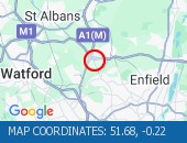
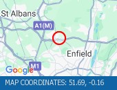
Nearest town: 16.52 miles from St Pancras. CLEARED @ 18:18CONGESTION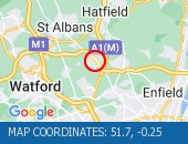 Location: The M25 clockwise between junctions J22 (St Albans) and J23 (Hatfield) .
Reason: Congestion.
Status: Currently Active.
Return to normal: Normal traffic conditions are expected between 19:15 and 19:30 on 9 May 2024.
Delay: There are currently delays of 10 minutes against expected traffic.
Earlier Reason: Caused by an earlier accident.
Nearest town: 13.65 miles from St Pancras. CLEARED @ 19:30CONGESTIONLocation: The M25 anticlockwise between junctions J8 (Reigate) and J7 (Gatwick) .
Reason: Congestion.
Status: Currently Active.
Return to normal: Normal traffic conditions are expected between 19:00 and 19:15 on 9 May 2024.
CauseRoad repairs.
Delay: There are currently delays of 10 minutes against expected traffic.
Nearest town: 18.31 miles from St Pancras. CLEARED @ 19:03
Lane closures: The hard shoulder, lanes 1 and 2 are closed.
Reason: Vehicle fire.
Status: Currently Active.
Time to clear: The event is expected to clear between 23:30 and 23:45 on 9 May 2024.
Return to normal: Normal traffic conditions are expected between 23:30 and 23:45 on 9 May 2024.
Lanes closed: There are two of three lanes closed.
Nearest town: 12.76 miles from St Pancras. CLEARED @ 23:06
Lane closures: Lane one is closed.
Reason: Broken down vehicle.
Status: Currently Active.
Time to clear: The event is expected to clear between 22:30 and 22:45 on 9 May 2024.
Return to normal: Normal traffic conditions are expected between 22:30 and 22:45 on 9 May 2024.
Lanes closed: There is one of four lanes closed.
Nearest town: 18.33 miles from St Pancras. CLEARED @ 21:45
Lane closures: The hard shoulder and lane 1 are closed.
Reason: Broken down vehicle.
Status: Currently Active.
Time to clear: The event is expected to clear between 20:00 and 20:15 on 9 May 2024.
Return to normal: Normal traffic conditions are expected between 20:00 and 20:15 on 9 May 2024.
Lanes closed: There is one of two lanes closed.
Nearest town: 19.69 miles from St Pancras. CLEARED @ 19:30
Lane closures: The hard shoulder and lane 1 are closed.
Reason: Broken down vehicle.
Status: Currently Active.
Time to clear: The event is expected to clear between 19:30 and 19:45 on 9 May 2024.
Return to normal: Normal traffic conditions are expected between 19:30 and 19:45 on 9 May 2024.
Lanes closed: There is one of four lanes closed.
Nearest town: 19.9 miles from St Pancras. CLEARED @ 19:03
Lane closures: The hard shoulder and lane 1 are closed.
Reason: Broken down vehicle.
Status: Currently Active.
Time to clear: The event is expected to clear between 19:00 and 19:15 on 9 May 2024.
Return to normal: Normal traffic conditions are expected between 19:00 and 19:15 on 9 May 2024.
Lanes closed: There is one of three lanes closed.
Nearest town: 14.25 miles from St Pancras. CLEARED @ 18:36
Lane closures: The hard shoulder and lane 1 are closed.
Reason: Road traffic collision.
Status: Currently Active.
Time to clear: The event is expected to clear between 19:45 and 20:00 on 9 May 2024.
Return to normal: Normal traffic conditions are expected between 19:45 and 20:00 on 9 May 2024.
Lanes closed: There is one of five lanes closed.
Nearest town: 16.97 miles from St Pancras. CLEARED @ 19:03
Lane closures: Lane one is closed.
Reason: Broken down vehicle.
Status: Currently Active.
Time to clear: The event is expected to clear between 19:00 and 19:15 on 9 May 2024.
Return to normal: Normal traffic conditions are expected between 19:00 and 19:15 on 9 May 2024.
Delay: There are currently delays of 10 minutes against expected traffic.
Lanes closed: There is one of four lanes closed.
Nearest town: 14.01 miles from St Pancras. CLEARED @ 18:45
Reason: Broken down vehicle.
Status: Currently Active.
Time to clear: The event is expected to clear between 18:45 and 19:00 on 9 May 2024.
Return to normal: Normal traffic conditions are expected between 18:45 and 19:00 on 9 May 2024.
Lanes closed: There are lane closures.
Nearest town: 12.76 miles from St Pancras. CLEARED @ 18:09
Reason: Road traffic collision.
Status: Cleared.
Nearest town: 15.84 miles from St Pancras. CLEARED @ 19:30
Lane closures: The hard shoulder and lane 1 are closed.
Reason: Broken down vehicle with a brake issue.
Status: Currently Active.
Time to clear: The event is expected to clear between 20:00 and 20:15 on 9 May 2024.
Return to normal: Normal traffic conditions are expected between 20:00 and 20:15 on 9 May 2024.
Lanes closed: There is one of four lanes closed.
Nearest town: 15.93 miles from St Pancras. CLEARED @ 19:12
Reason: Congestion.
Status: Currently Active.
Return to normal: Normal traffic conditions are expected between 23:45 and 00:00 on 10 May 2024.
Delay: There are currently delays of 15 minutes against expected traffic.
Nearest town: 13.5 miles from St Pancras.
Reason: Congestion.
Status: Currently Active.
Return to normal: Normal traffic conditions are expected between 23:45 and 00:00 on 10 May 2024.
Delay: There are currently delays of 10 minutes against expected traffic.
Nearest town: 18.21 miles from St Pancras.
Reason: Congestion.
Status: Currently Active.
Return to normal: Normal traffic conditions are expected between 23:45 and 00:00 on 10 May 2024.
Delay: There are currently delays of 15 minutes against expected traffic.
Nearest town: 19.71 miles from St Pancras.
Reason: Congestion.
Status: Currently Active.
Return to normal: Normal traffic conditions are expected between 20:45 and 21:00 on 9 May 2024.
Nearest town: 17.08 miles from St Pancras. CLEARED @ 20:51
Reason: Congestion.
Status: Currently Active.
Return to normal: Normal traffic conditions are expected between 20:15 and 20:30 on 9 May 2024.
Delay: There are currently delays of 10 minutes against expected traffic.
Nearest town: 7.54 miles from St Pancras. CLEARED @ 20:15
Reason: Congestion.
Status: Currently Active.
Return to normal: Normal traffic conditions are expected between 20:00 and 20:15 on 9 May 2024.
Nearest town: 19.56 miles from St Pancras. CLEARED @ 20:06
Reason: Congestion.
Status: Currently Active.
Return to normal: Normal traffic conditions are expected between 19:30 and 19:45 on 9 May 2024.
Delay: There are currently delays of 10 minutes against expected traffic.
Nearest town: 6.83 miles from St Pancras. CLEARED @ 19:39
Reason: Congestion.
Status: Currently Active.
Return to normal: Normal traffic conditions are expected between 19:45 and 20:00 on 9 May 2024.
Delay: There are currently delays of 10 minutes against expected traffic.
Nearest town: 18.99 miles from St Pancras. CLEARED @ 19:57
Reason: Congestion.
Status: Currently Active.
Return to normal: Normal traffic conditions are expected between 19:30 and 19:45 on 9 May 2024.
Delay: There are currently delays of 10 minutes against expected traffic.
Nearest town: 18.31 miles from St Pancras. CLEARED @ 19:30
Reason: Congestion.
Status: Currently Active.
Return to normal: Normal traffic conditions are expected between 19:00 and 19:15 on 9 May 2024.
Delay: There are currently delays of 10 minutes against expected traffic.
Nearest town: 19.55 miles from St Pancras. CLEARED @ 19:12
Reason: Congestion.
Status: Currently Active.
Return to normal: Normal traffic conditions are expected between 19:15 and 19:30 on 9 May 2024.
Delay: There are currently delays of 10 minutes against expected traffic.
Nearest town: 19.56 miles from St Pancras. CLEARED @ 19:21
Reason: Congestion.
Status: Currently Active.
Return to normal: Normal traffic conditions are expected between 19:15 and 19:30 on 9 May 2024.
Nearest town: 16.52 miles from St Pancras. CLEARED @ 19:12
Reason: Congestion.
Status: Currently Active.
Return to normal: Normal traffic conditions are expected between 19:00 and 19:15 on 9 May 2024.
Delay: There are currently delays of 10 minutes against expected traffic.
Nearest town: 15.38 miles from St Pancras. CLEARED @ 19:12
Reason: Congestion.
Status: Currently Active.
Return to normal: Normal traffic conditions are expected between 19:00 and 19:15 on 9 May 2024.
Nearest town: 17.08 miles from St Pancras. CLEARED @ 19:03
Reason: Congestion.
Status: Currently Active.
Return to normal: Normal traffic conditions are expected between 18:45 and 19:00 on 9 May 2024.
Delay: There are currently delays of 10 minutes against expected traffic.
Nearest town: 16.75 miles from St Pancras. CLEARED @ 18:54
Reason: Congestion.
Status: Currently Active.
Return to normal: Normal traffic conditions are expected between 18:45 and 19:00 on 9 May 2024.
Delay: There are currently delays of 10 minutes against expected traffic.
Nearest town: 19.31 miles from St Pancras. CLEARED @ 18:54
Reason: Congestion.
Status: Currently Active.
Return to normal: Normal traffic conditions are expected between 18:45 and 19:00 on 9 May 2024.
Delay: There are currently delays of 10 minutes against expected traffic.
Nearest town: 17.03 miles from St Pancras. CLEARED @ 18:54
Reason: Congestion.
Status: Currently Active.
Return to normal: Normal traffic conditions are expected between 18:45 and 19:00 on 9 May 2024.
Delay: There are currently delays of 10 minutes against expected traffic.
Nearest town: 19.7 miles from St Pancras. CLEARED @ 18:45
Reason: Congestion.
Status: Currently Active.
Return to normal: Normal traffic conditions are expected between 18:45 and 19:00 on 9 May 2024.
Delay: There are currently delays of 10 minutes against expected traffic.
Nearest town: 19.55 miles from St Pancras. CLEARED @ 18:45
Reason: Congestion.
Status: Currently Active.
Return to normal: Normal traffic conditions are expected between 18:45 and 19:00 on 9 May 2024.
Nearest town: 17.28 miles from St Pancras. CLEARED @ 18:54
Reason: Congestion.
Status: Currently Active.
Return to normal: Normal traffic conditions are expected between 18:45 and 19:00 on 9 May 2024.
Delay: There are currently delays of 10 minutes against expected traffic.
Nearest town: 19.58 miles from St Pancras. CLEARED @ 18:45
Reason: Congestion.
Status: Currently Active.
Return to normal: Normal traffic conditions are expected between 18:45 and 19:00 on 9 May 2024.
Nearest town: 14.56 miles from St Pancras. CLEARED @ 18:45
Reason: Congestion.
Status: Currently Active.
Return to normal: Normal traffic conditions are expected between 18:30 and 18:45 on 9 May 2024.
Delay: There are currently delays of 10 minutes against expected traffic.
Nearest town: 17.12 miles from St Pancras. CLEARED @ 18:36
Reason: Congestion.
Status: Currently Active.
Return to normal: Normal traffic conditions are expected between 18:45 and 19:00 on 9 May 2024.
Delay: There are currently delays of 10 minutes against expected traffic.
Nearest town: 19.56 miles from St Pancras. CLEARED @ 18:54
Reason: Congestion.
Status: Currently Active.
Return to normal: Normal traffic conditions are expected between 19:15 and 19:30 on 9 May 2024.
Nearest town: 18.47 miles from St Pancras. CLEARED @ 19:21
Reason: Congestion.
Status: Currently Active.
Return to normal: Normal traffic conditions are expected between 18:30 and 18:45 on 9 May 2024.
Delay: There are currently delays of 10 minutes against expected traffic.
Nearest town: 16.58 miles from St Pancras. CLEARED @ 18:36
Reason: Congestion.
Status: Currently Active.
Return to normal: Normal traffic conditions are expected between 18:30 and 18:45 on 9 May 2024.
Delay: There are currently delays of 10 minutes against expected traffic.
Nearest town: 18.33 miles from St Pancras. CLEARED @ 18:27
Reason: Congestion.
Status: Currently Active.
Return to normal: Normal traffic conditions are expected between 18:30 and 18:45 on 9 May 2024.
Delay: There are currently delays of 10 minutes against expected traffic.
Nearest town: 12.03 miles from St Pancras. CLEARED @ 18:27
Reason: Congestion.
Status: Currently Active.
Return to normal: Normal traffic conditions are expected between 18:45 and 19:00 on 9 May 2024.
Delay: There are currently delays of 10 minutes against expected traffic.
Nearest town: 18.44 miles from St Pancras. CLEARED @ 18:45
Reason: Congestion.
Status: Currently Active.
Return to normal: Normal traffic conditions are expected between 19:15 and 19:30 on 9 May 2024.
Nearest town: 14.93 miles from St Pancras. CLEARED @ 19:12
Reason: Congestion.
Status: Currently Active.
Return to normal: Normal traffic conditions are expected between 18:00 and 18:15 on 9 May 2024.
Delay: There are currently delays of 10 minutes against expected traffic.
Nearest town: 17.12 miles from St Pancras. CLEARED @ 18:09
Reason: Congestion.
Status: Currently Active.
Return to normal: Normal traffic conditions are expected between 18:30 and 18:45 on 9 May 2024.
Delay: There are currently delays of 10 minutes against expected traffic.
Nearest town: 12.3 miles from St Pancras. CLEARED @ 18:27
Reason: Congestion.
Status: Currently Active.
Return to normal: Normal traffic conditions are expected between 18:45 and 19:00 on 9 May 2024.
Delay: There are currently delays of 10 minutes against expected traffic.
Nearest town: 17.51 miles from St Pancras. CLEARED @ 18:27
Reason: Congestion.
Status: Currently Active.
Return to normal: Normal traffic conditions are expected between 18:45 and 19:00 on 9 May 2024.
Delay: There are currently delays of 10 minutes against expected traffic.
Nearest town: 17.19 miles from St Pancras. CLEARED @ 18:45
Reason: Congestion.
Status: Currently Active.
Return to normal: Normal traffic conditions are expected between 18:45 and 19:00 on 9 May 2024.
Delay: There are currently delays of 10 minutes against expected traffic.
Nearest town: 14.19 miles from St Pancras. CLEARED @ 18:45
Reason: Congestion.
Status: Currently Active.
Return to normal: Normal traffic conditions are expected between 18:30 and 18:45 on 9 May 2024.
Nearest town: 17.03 miles from St Pancras. CLEARED @ 18:36
Reason: Congestion.
Status: Currently Active.
Return to normal: Normal traffic conditions are expected between 18:30 and 18:45 on 9 May 2024.
Delay: There are currently delays of 10 minutes against expected traffic.
Nearest town: 12.12 miles from St Pancras. CLEARED @ 18:18
Reason: Congestion.
Status: Currently Active.
Return to normal: Normal traffic conditions are expected between 18:00 and 18:15 on 9 May 2024.
Nearest town: 12.69 miles from St Pancras. CLEARED @ 18:00
Reason: Congestion.
Status: Currently Active.
Return to normal: Normal traffic conditions are expected between 18:00 and 18:15 on 9 May 2024.
Nearest town: 16.73 miles from St Pancras. CLEARED @ 18:00
Reason: Congestion.
Status: Currently Active.
Return to normal: Normal traffic conditions are expected between 18:45 and 19:00 on 9 May 2024.
Delay: There are currently delays of 20 minutes against expected traffic.
Nearest town: 14.47 miles from St Pancras. CLEARED @ 18:54
Reason: Congestion.
Status: Currently Active.
Return to normal: Normal traffic conditions are expected between 18:00 and 18:15 on 9 May 2024.
Delay: There are currently delays of 10 minutes against expected traffic.
Nearest town: 17.81 miles from St Pancras. CLEARED @ 18:00
Reason: Congestion.
Status: Currently Active.
Return to normal: Normal traffic conditions are expected between 19:00 and 19:15 on 9 May 2024.
Delay: There are currently delays of 10 minutes against expected traffic.
Nearest town: 12.72 miles from St Pancras. CLEARED @ 19:03
Reason: Congestion.
Status: Currently Active.
Return to normal: Normal traffic conditions are expected between 19:00 and 19:15 on 9 May 2024.
Delay: There are currently delays of 10 minutes against expected traffic.
Nearest town: 19.55 miles from St Pancras. CLEARED @ 18:27
Reason: Congestion.
Status: Currently Active.
Return to normal: Normal traffic conditions are expected between 18:00 and 18:15 on 9 May 2024.
Delay: There are currently delays of 10 minutes against expected traffic.
Nearest town: 14.79 miles from St Pancras. CLEARED @ 18:00
Reason: Congestion.
Status: Currently Active.
Return to normal: Normal traffic conditions are expected between 18:00 and 18:15 on 9 May 2024.
Nearest town: 16.55 miles from St Pancras. CLEARED @ 18:00
Reason: Congestion.
Status: Currently Active.
Return to normal: Normal traffic conditions are expected between 18:30 and 18:45 on 9 May 2024.
CauseBroken down vehicle.
Delay: There are currently delays of 10 minutes against expected traffic.
Nearest town: 15.14 miles from St Pancras. CLEARED @ 18:36
Reason: Congestion.
Status: Currently Active.
Return to normal: Normal traffic conditions are expected between 18:00 and 18:15 on 9 May 2024.
Delay: There are currently delays of 10 minutes against expected traffic.
Nearest town: 19.59 miles from St Pancras. CLEARED @ 18:09
Reason: Congestion.
Status: Currently Active.
Return to normal: Normal traffic conditions are expected between 18:15 and 18:30 on 9 May 2024.
Delay: There are currently delays of 10 minutes against expected traffic.
Nearest town: 16.52 miles from St Pancras. CLEARED @ 18:18
Reason: Congestion.
Status: Currently Active.
Return to normal: Normal traffic conditions are expected between 19:15 and 19:30 on 9 May 2024.
Delay: There are currently delays of 10 minutes against expected traffic.
Earlier Reason: Caused by an earlier accident.
Nearest town: 13.65 miles from St Pancras. CLEARED @ 19:30
Reason: Congestion.
Status: Currently Active.
Return to normal: Normal traffic conditions are expected between 19:00 and 19:15 on 9 May 2024.
CauseRoad repairs.
Delay: There are currently delays of 10 minutes against expected traffic.
Nearest town: 18.31 miles from St Pancras. CLEARED @ 19:03
There are no current incidents in this location.


 National Highways England
 Transport for London (TFL)
 Traffic Wales
 Traffic Scotland
 YOUR AD HERE